
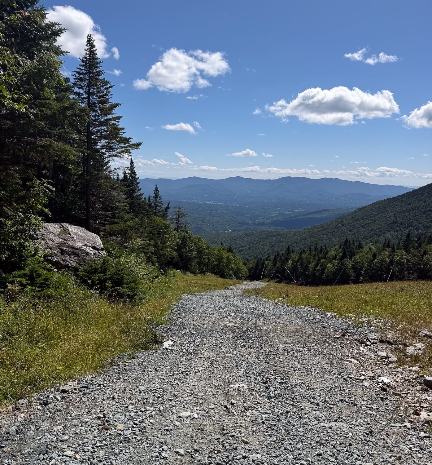
As we move into leaf-peeping season (this is a viable leg burner outside autumn, too), here’s a look at great get-the-vert-in at Stowe Mountain Resort on Vermont’s Mount Mansfield.
Leg Burner Stats
| Metric | Mt. Mansfiield base → Top of Gondi |
| Trailhead | Base of gondi at Stowe (1,559 ft) |
| Summit (top of gondi) | Top of gondi (3,625 ft) |
| Distance, one way | 1.92 miles |
| Distance, round trip | 3.84 miles |
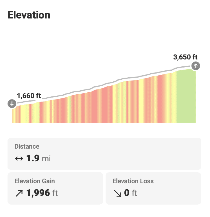
| Vertical gain | 1,936 ft |
| Average grade, whole climb | 18.6% !!!! |
| Descent options | Reverse the route, download on gondi. See summer trail map for other options. |
| Season | Late spring through mid-October. Late June to mid-October if downloading. |
| Cost | Free parking at resort base and a free ride down on the gondi. |
| Water | Water at summit lodge if during operating hours. |
The Route
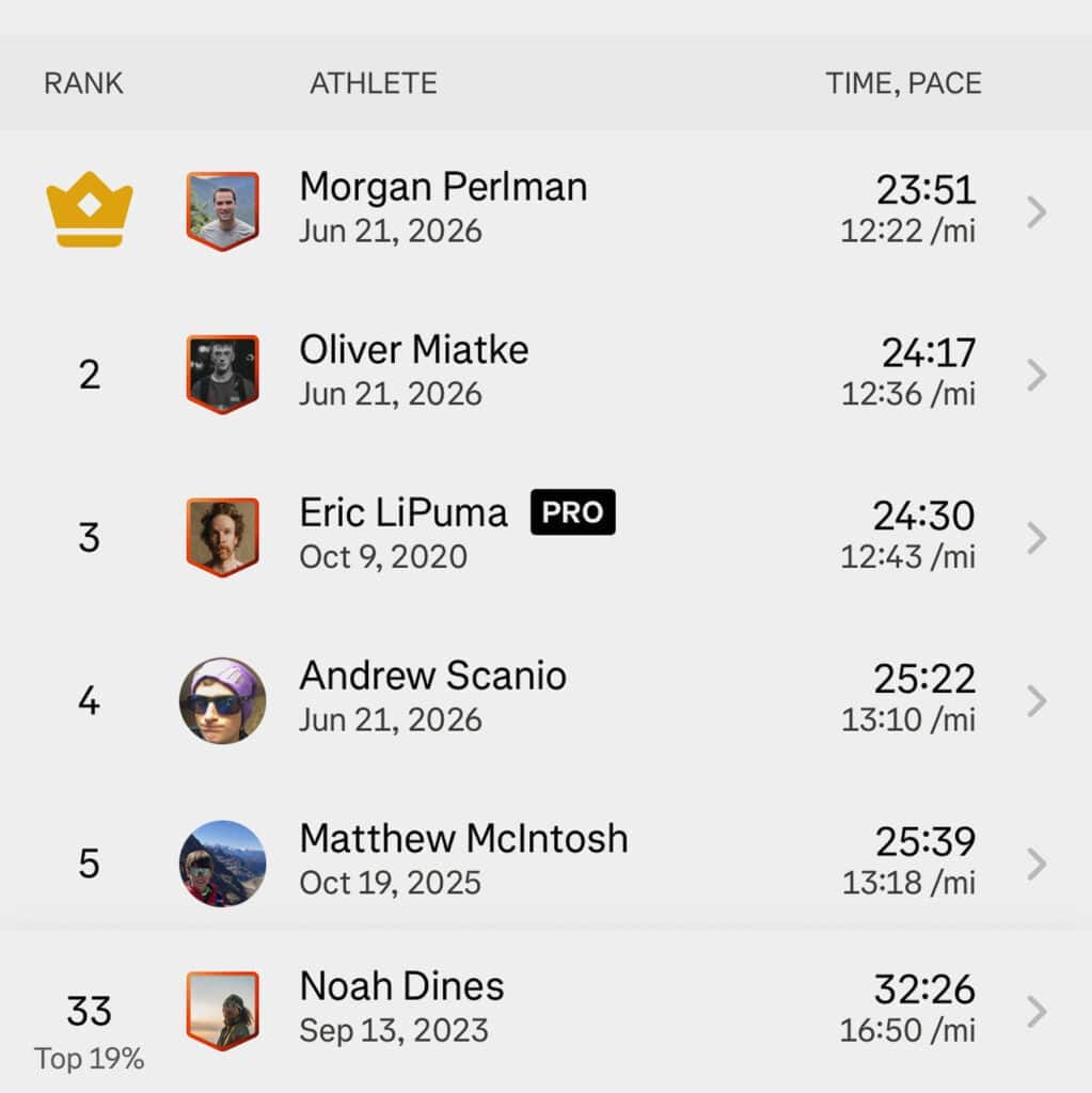
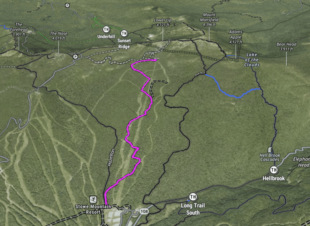
My favorite leg burner is the work road to the top of the gondi at Stowe (the ski area) on Mount Mansfield (the actual mountain). It’s almost exactly a 2000-foot climb that starts right on the Perry Merrill Trail—at the resort base—and sneaks past and switchbacks up to the top of the gondola. The grades are quite steep in places, but for most of it, they’re very runnable; the rest is power-hikeable.
It’s great to go up and run down if you’re looking for downhill vert, or to take the gondola down when it’s running and bypass the knee pounding. It’s been my go-to. Since it is on a ski hill, it feels like training; You’re there for fitness. An upside is that since you’re on a ski hill and you’re in Vermont, it’s cut, so you actually have views.
This leg burner starts with a couple of long switchbacks, which then kick up into a steep section that’s sustained from about 800′ to 1200′ (or your total vert) or so. That section can be punishing, especially in the sun. After that push, the grade mellows a bit and snakes upward as you climb toward the gondola’s top station. It’s great.
Going down
Three options, and this is where the route earns its keep.
- Reverse it. Take a breather up top, hydrate, and pivot.
- Loop it. See the summer trail map. You have many options. Since you made the effort and you are not short on time, head on up to The Chin (4,395 ft.) and The Nose (4,063 ft.).
- Download. As noted…free! In-season operating hours apply here (daily, weather permitting 10 a.m. – 4:30 p.m.
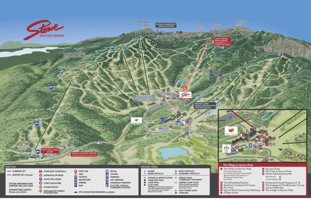
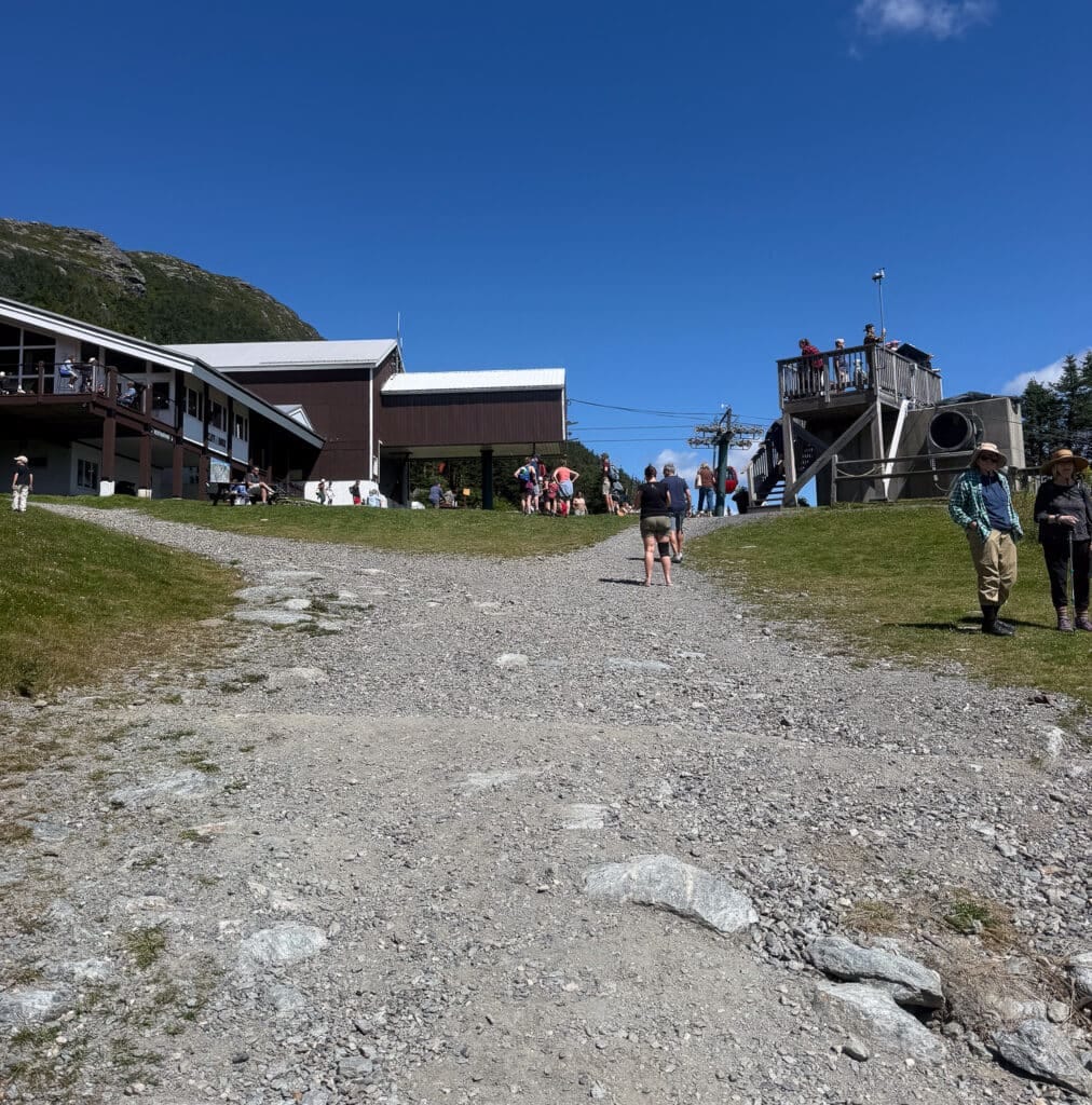
Whether it’s just for a quick hit when you’ve got a bit of time, or if you’re doing a longer effort of two or three laps trying to build some endurance, this will have you covered. Good views, relatively good surface—it can be somewhat loose depending on the time of year and recent moisture, but it’s a road with little traffic. Sometimes you run into a ton of tourists at the top, which is always fun. They ask you how long it took to get up there, or other questions like that. So be prepared.
Alternatives
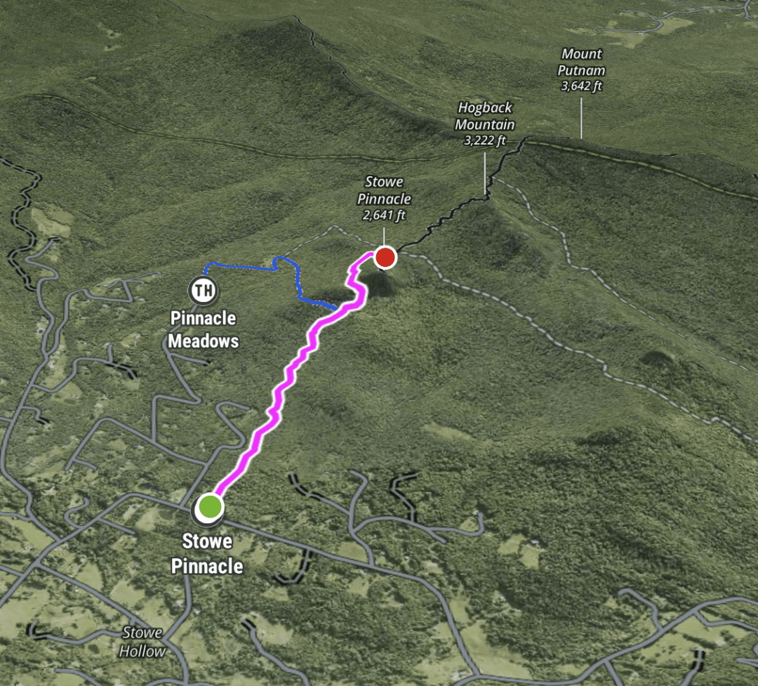
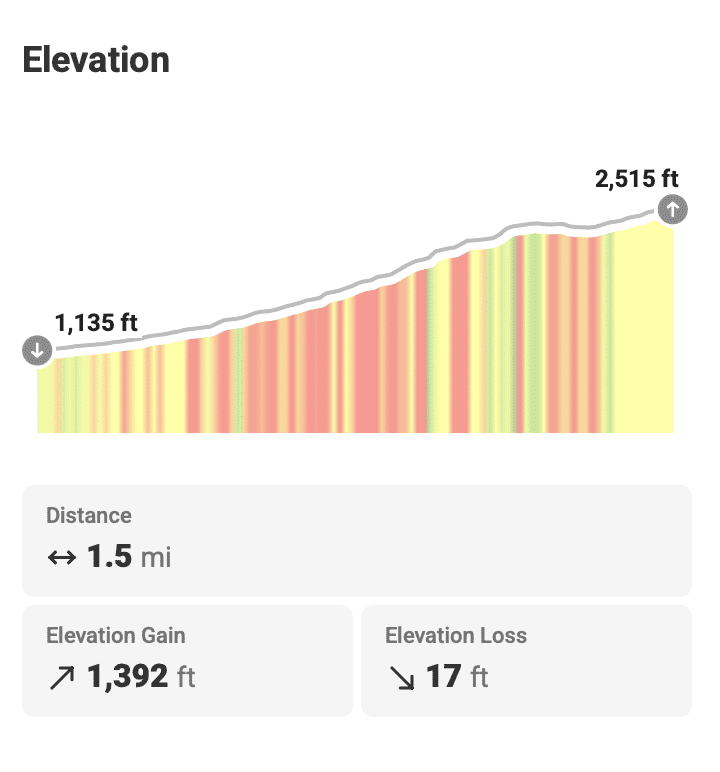
Take a look at the summer trail map and note options mentioned already, like heading up into the alpine. However, for a more trail-running-specific option, I often default to a run up to Stowe Pinnacle. See below for the details.
Leave a Reply
You must be logged in to post a comment.