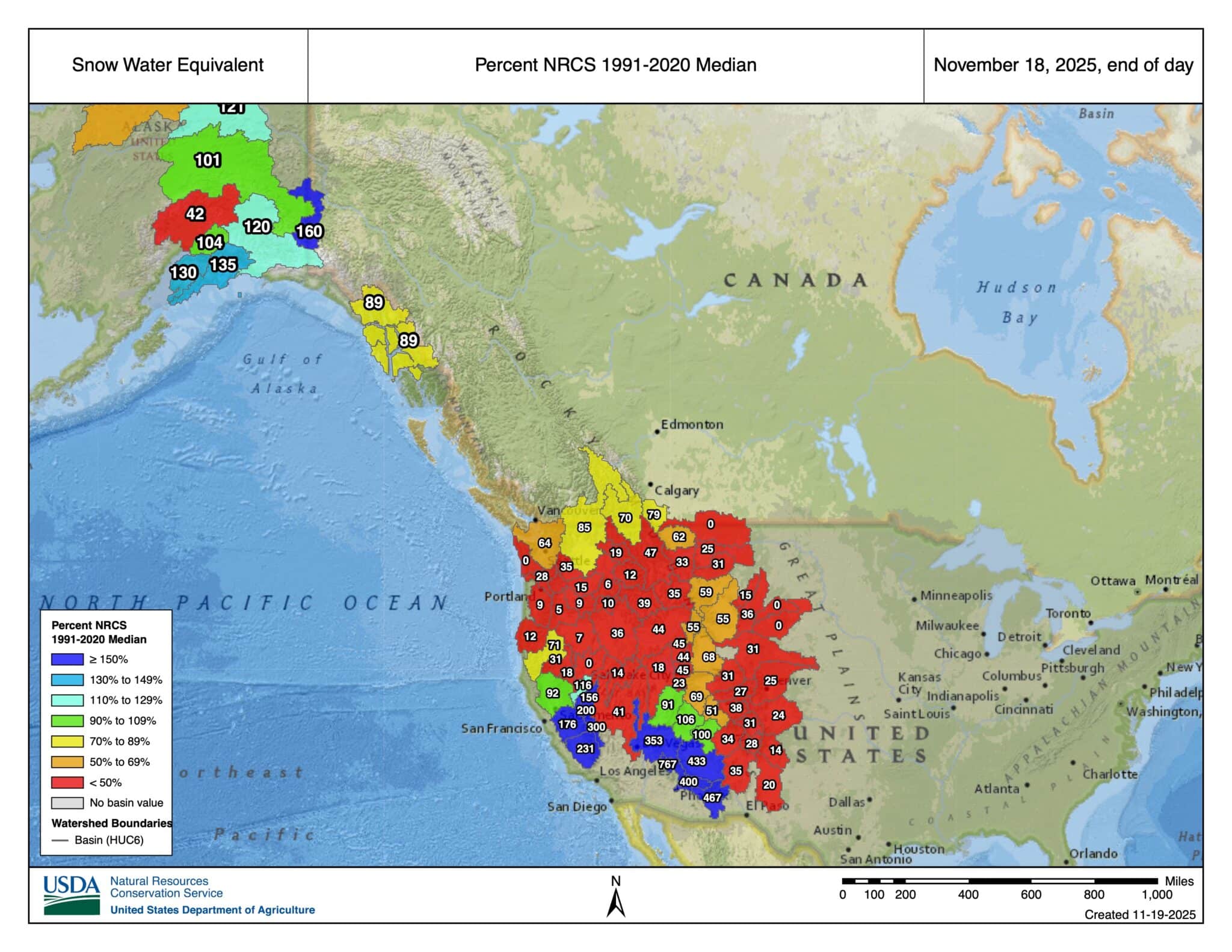
In the animal kingdom, red can be a warning, as in “move or you’ll be bitten,” or, in some cases, a sign to attract a mate. It has come to our attention that red is a predominant color on the Snow Water Equivalent map from the NRCS. In the case of the SWE map, it is neither. It is something far worse. It means heading into a holiday week (it is only Thursday), that running, biking, or walking will be the plan, not touring.
Damn, look at this map. There are some bright spots out there—we’re looking at you, SoCal. It’s a solid 5%-7% of the median where I live. Not all is lost. And we mean this, because we tend to be somewhat West-Centric at THR: We are stoked for the folks back East. According to some remote sensor data, near the summit of Mount Washington in the White Mountains, they are looking at roughly 24” of snow. A preview of some East Coast touring blogs reveals what the data supports: good touring and fine turns have been had :).