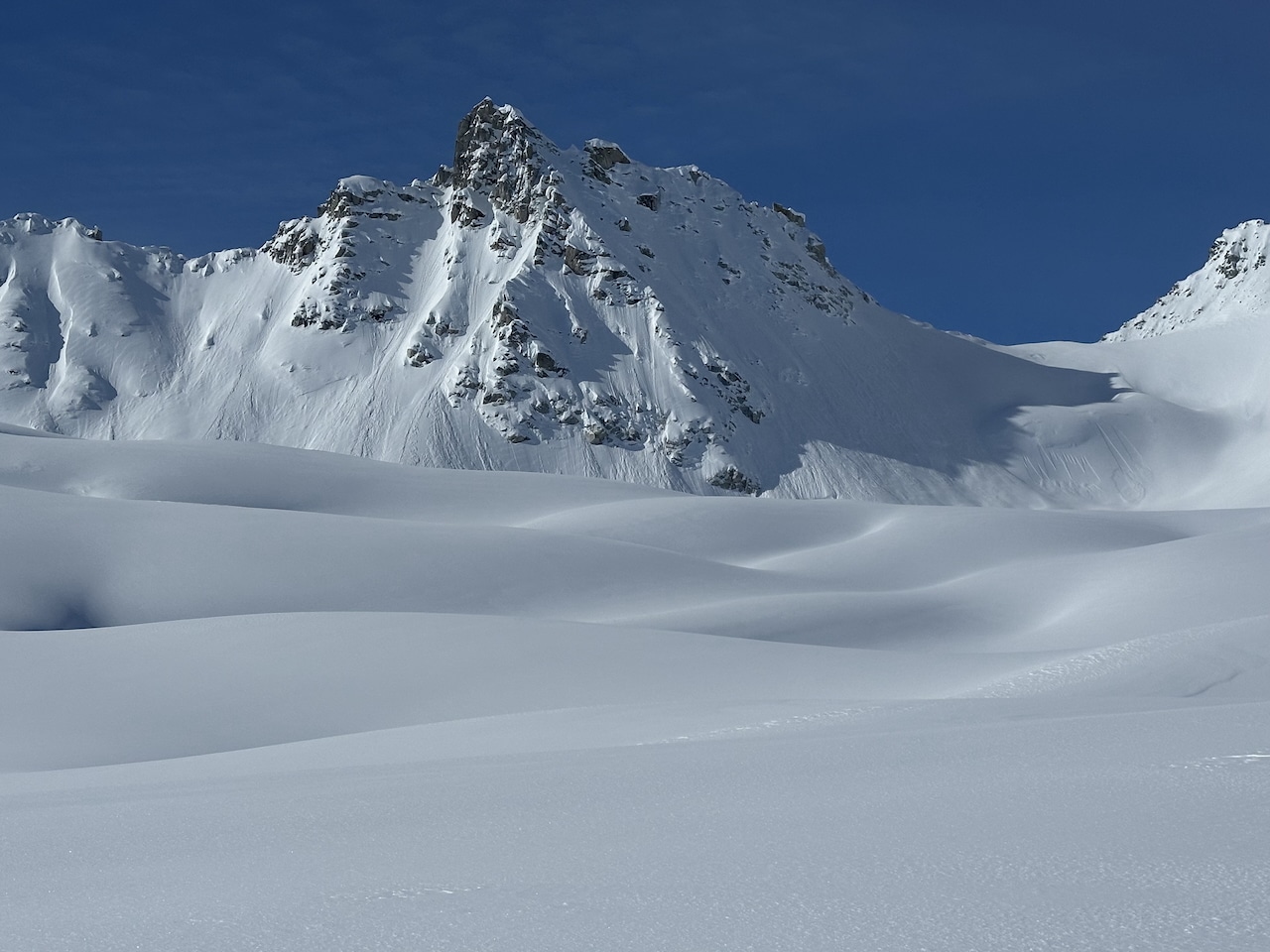
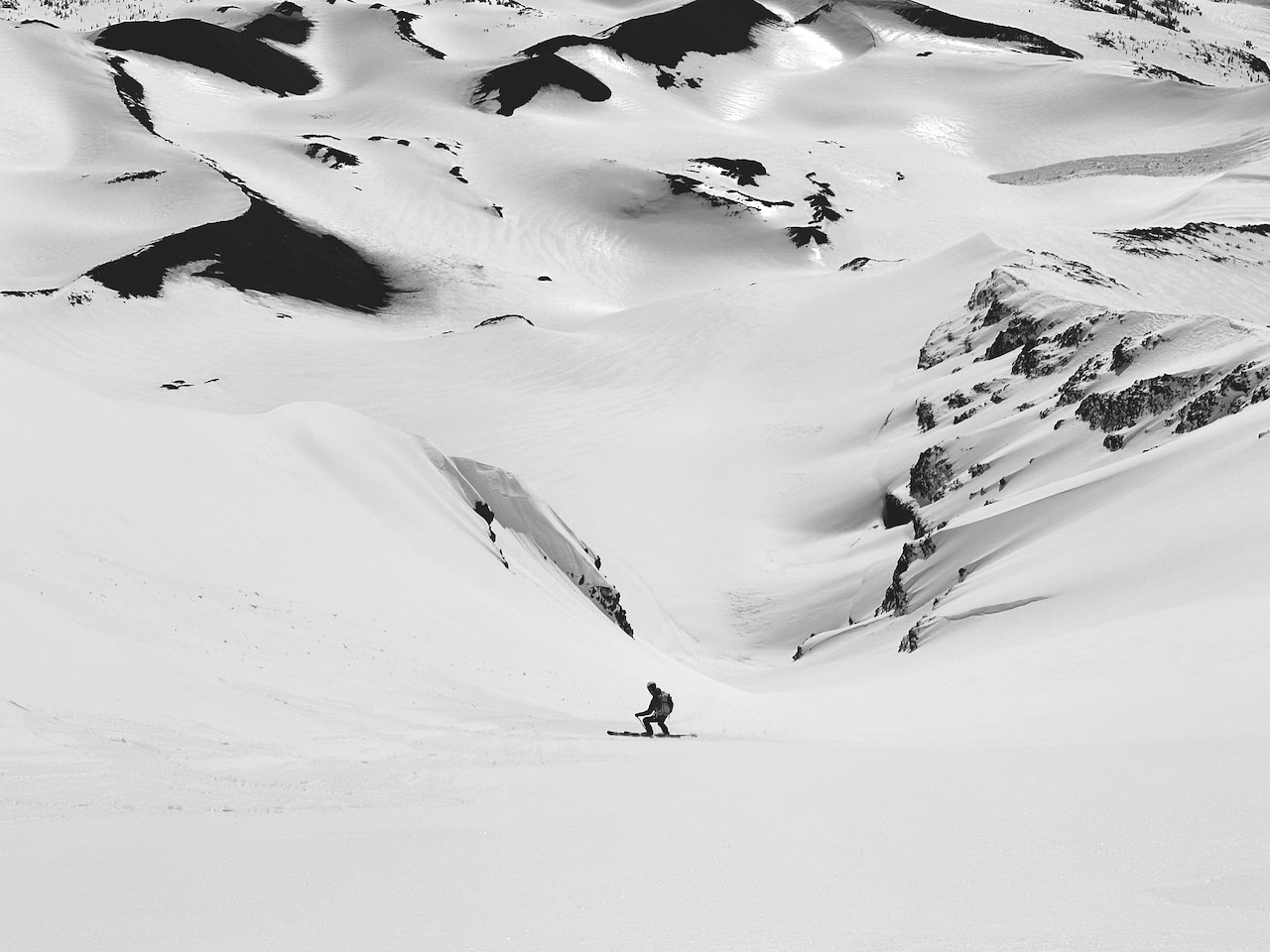
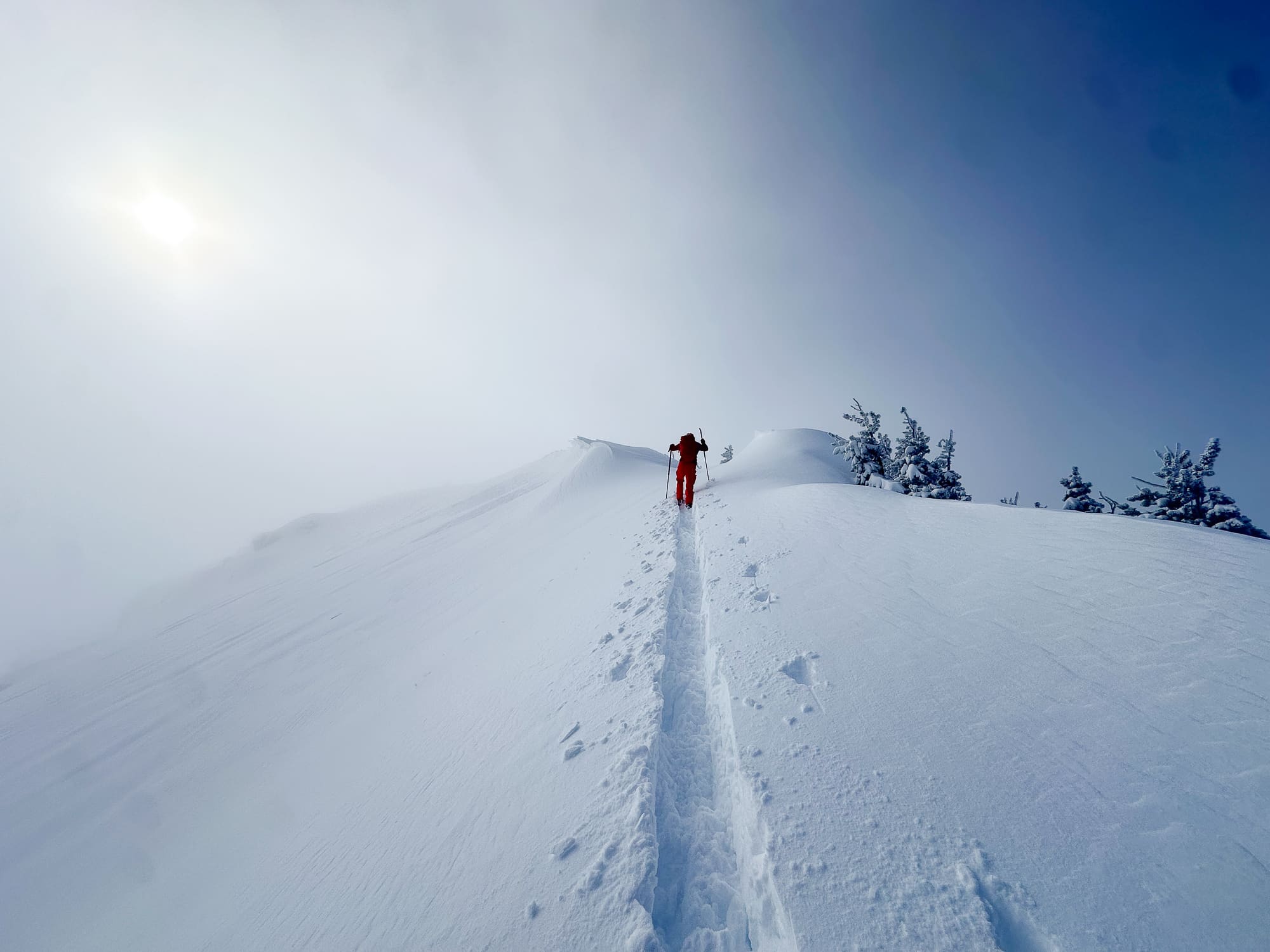
A bit of hand-holding would be in order this week. About a ½ mile downriver from the house is the 2023 International Snow Science Conference (ISSW). The ISSW is, for all practical purposes, an academic conference with a strong tilt toward a topic we are all likely interested in—avalanches and how to predict and avoid them. There are some heady presentations. As an enthusiast, there are also excellent takeaways and new material to absorb. We’ll be highlighting some of those in the coming weeks.

Hats off to the ISSW organizers—they should be proud. And thanks to Aaron Diamond for editing assistance. 


First up is a paper by Grant Statham and Cam Campbell titled “The Avalanche Terrain Exposure Scale V.2.” We spoke to Statham, a mountain rescue specialist and avalanche forecaster for Parks Canada and an IFMGA guide, to learn more about this new work..


ATES Background

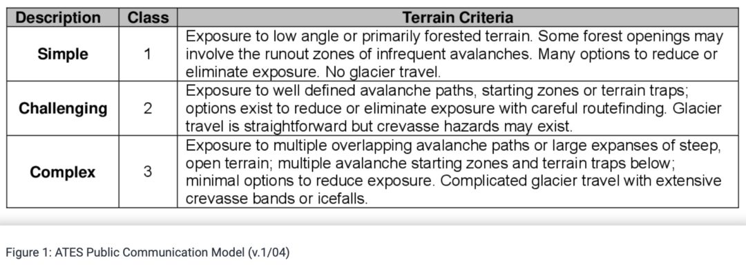
The tried and true public ATES paradigm uses three classifications: simple, challenging, and complex. (See chart below.) As noted, depending on your objective, skills, and experience, an ATES rating provides some historical context to one’s relative exposure to avalanches. An ATES classification is static: it does not change due to a day’s or week’s forecast or known instabilities— in other words, the likelihood of an avalanche occurring during your tour on any given day. The ATES becomes a reliable and fixed system we can rely on. The goal is to give the public user a tool to help them differentiate between different trips and combined with a current forecast choose a trip that fits the conditions. 

The authors write about the original ATES, “ratings are determined using both qualitative and quantitative analyses and result in a subjective measure of the degree of avalanche terrain exposure on a discrete five-level scale. Unlike the transient nature of avalanche hazard assessment, which rises and falls with the changing weather and snowpack conditions, ATES ratings are based upon constant parameters that do not change (e.g., slope angle, exposure) or change slowly (e.g., avalanche frequency, forest density), resulting in a static, unchanging terrain rating.”


Although the ATES has been widely adopted in Canada, it has yet to gain a critical foothold in the U.S. Some of you might be familiar with Beacon Guidebooks, a Colorado-based ski atlas and map company, which applies the ATES effectively in its products. Some regions in the U.S. use the system as well. (According to Statham, the implementation of Auto-ATES might change this dynamic. “We have an algorithm now that does the terrain grading automatically. So that changes everything because now it can be done easily,” said Statham.)

Two devastating avalanches in 2003, one of which killed 17 young students on Rodgers Pass, prompted the development of the ATES.   

“It was after that, and, upon review of that avalanche, it became clear that we didn’t have very good tools to tell the public, believe it or not, that this particular trip is more risky than that particular trip,” said Statham. “We had no way to differentiate between the magnitude of the trip [from an avalanche perspective] for the public, which seems like a very basic thing you want to be able to say. This system was designed to meet that need.”


The new ATES v.2 and The “0”

A new ATES system, codified as ATES v.2, rates terrain between 0-4, with 0=non-avalanche, 1=simple, 2=challenging, 3=complex, and 4=extreme, respectively. 

The introduction of “0”, described as “No known exposure to avalanches. Very low-angle or densely forested slopes located well away from avalanche paths, or designated trails/routes with no exposure to avalanches,” allows for a broader interpretation of the terrain.

Statham says the “0” was never really picked up by the community. Now, built into the categories with iteration v.2, he hopes it serves a critical need. 

“I think it’s the most important level,” he said. “Most people don’t want to go to avalanche terrain. Some of us might want to go skiing, but most people who come to the park where I work just want to figure out where they can go with their family and go for a walk, snowshoeing, or something where they can be safe. That sounds really simple, but it’s actually one of the hardest layers to produce. So we need to get that in there.”


Class 4-Extreme Terrain

ATES v.2 also introduces “Class 4- Extreme Terrain”, which, as the name implies, is a potentially high-hazard zone. Statham explained that much of the terrain in the mountains becomes complex to a certain degree and thus becomes a broad category. Statham said the original ATES scale, with its three categories, could have been more valuable to experienced backcountry users. The new system recognizes this need and splits the upper end to include complex terrain and beyond.

The new five-tiered system helps improve the older system in a few ways. The authors use what they refer to as a communication model specific to “waterfall ice climbing” or “backcountry travel,” to get the message out using clear language. 

(Statham, an avid ice climber, has been part of a group working on the Ice Climbing Atlas Project that allows practitioners to better understand, from an avalanche perspective, the terrain they ascend and descend. Exposure to avalanches while ice climbing is a real hazard to technical climbers in the Canadian Rockies, and this project serves as a heads-up for those recreating in the mountains.)


Communication

The communication model speaks directly to those user groups but differs in the language used to target specific user groups. 

  • For example, Complex terrain for backcountry travelers is described as “Exposure to multiple overlapping avalanche paths or large expanses of steep, open terrain. Frequent exposure to overhead hazard. Many avalanche starting zones and terrain traps with minimal options to reduce exposure.
  • Complex terrain for waterfall ice climbing is described as “Routes with long exposure to high frequency avalanches starting from above or crossing steep slopes with terrain traps below. Minimal options to reduce exposure.”


The Technicalities

The second part of ATES v.2 is the “technical model,” and as the name suggests; it gets more granular. The authors state, “The ATES Technical Model is designed for avalanche terrain identification, analysis and evaluation to determine an ATES rating.” 

This is also where the authors turn an eye toward the myriad ways ATES can be applied in the digital/spatial mapping space. The zones, corridors, and routes we frequent encompass terrain with differing ATES descriptions. ATES v.2 uses eight parameters, each with five defining characteristics, to help determine the class rating between 0-4.


Applications 

Statham envisions the communication and technical models as serving two discrete purposes with some potential overlap. 

“If I needed to read some terrain, I would use a technical model,” Statham said. “And I would get some mapping work, travel the terrain, do all my assessment work, and base it on the technical model. I would ensure that the terrain I’m reading is grouped properly to fit the right slope angles and frequencies, and all the parameters in that technical model. 

“I would get my assessment completed that way. And then, I would have to figure out how I was going to communicate that. Where I work in the park, we have the relevant information on our website; we may have it on a brochure to hand out, or on the Web. We would use the communication model to say, ‘Alright, this trip here, you are hiking up to Mirror Lake, is class 2.’ You can see and decipher what the definition of class 2 is, but you’re not looking at the technical stuff—you’re looking at the communication version.”

The development of ATES v.2 seems like an acknowledgment of the myriad ways we graphically represent terrain and data. “Application of the ATES should start by considering the objectives of the final product, which informs the assessment and mapping approach. The objective and approach depend on the target audience and their intended application,” the authors explain in the paper presented at ISSW.

The new system has built into it many layers to accommodate different ways of spatially representing ATES ratings on the landscape we access. Some mapping products may call for broad generalities when defining an ATES category, whereas others may require differing ATES designations at a relatively small scale. It seems ATES v.2 will accommodate such products. 

For us backcountry tourers, this is progress. In their conclusion, the authors speak to an eventuality where “specific routes can be given a terrain rating, or a series of ratings, that accompany a route description. This method is similar to how rating systems are used for rock climbing or whitewater.”

Statham adds, “You go on mountain biking trips, you want to figure out where the hard trails are, where the intermediate trails are, and where the easy trails are. It’s essential for helping us plan the trips that we want to do because we want to make sure we’re doing one that’s matched up properly with our skill set. 

“And that’s what this system does for avalanche terrain in the event, for example, this trip over here is really complex. And the avalanche danger is high today. So forget it. I can’t go there today. Today, I have to stick to simple terrain. So what are my choices? Here are some straightforward, simple trips that will fit the high avalanche dangers. I can keep my exposure low.”

Consider it a more fine tuned method to help the community discern where to go when the avalanche danger is high, ATES v.2 should help us choose lower-risk and safe terrain to enjoy a day out meadow skipping and help a higher end user group sort through their terrain options on the right day.

(Again, this system does not consider real-time weather fluxes—it focuses on terrain, not the snowpack, which has dynamic properties; you still need to analyze, problem-solve, and communicate.)