
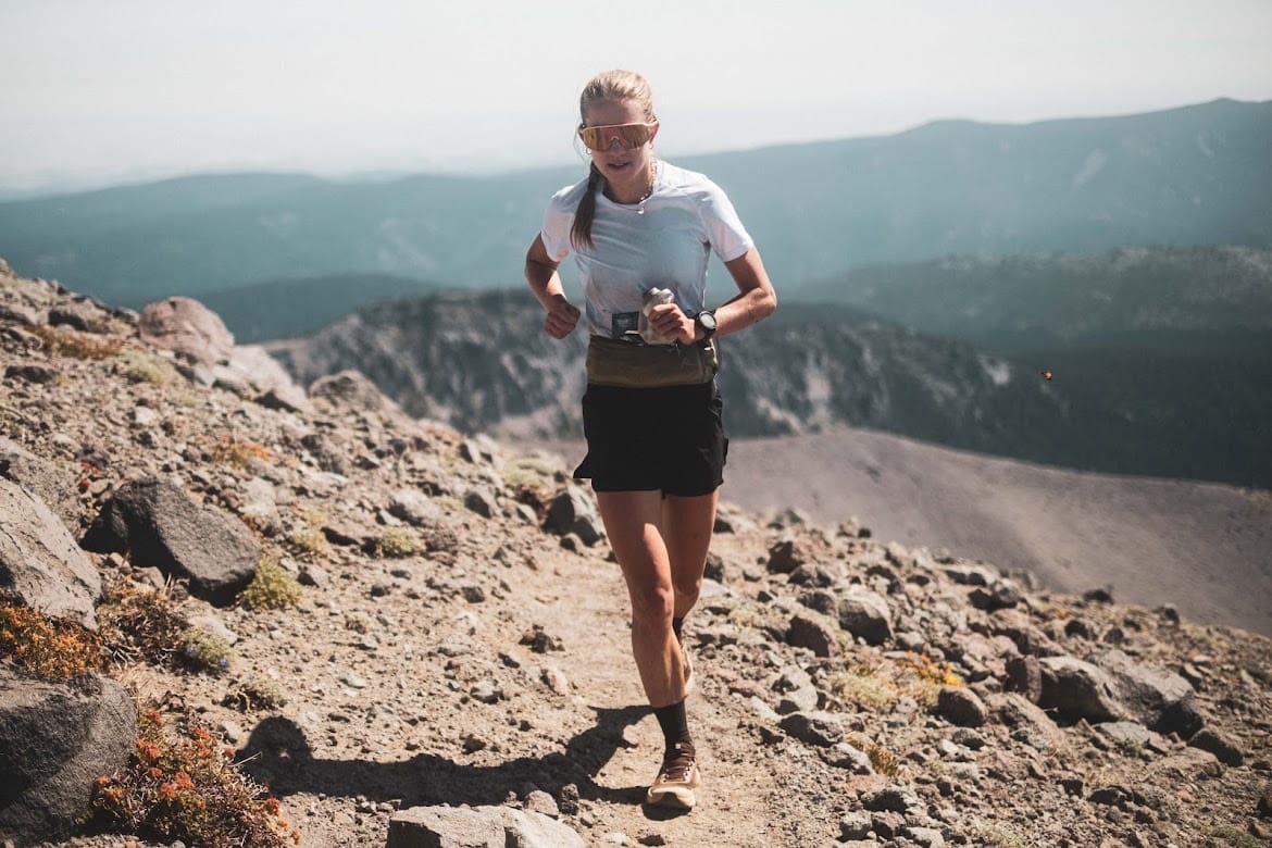
As we transition from the summer months of long days and warm nights into fall, the anticipation of snow builds. The not-so-distant memories of switchback climbs and powder descents start to dance their way to the forefront of our minds. With that comes the necessary physical and mental preparation to get our bodies ready to meet the mountains in their winter beauty. I’ve chosen to showcase two climbs in the Mount Washington Valley. They’re very different climbs, but I encourage the same mindset: gratitude in motion. Notice the nuances that make each climb unique. Enjoy and experience each step with presence, because we GET to be here moving, breathing, exploring, living in the mountains, and this is the ultimate expression.
Climb #1: The Classic—Tuckerman Ravine Trail to Mt. Washington
The Route:
The classic way up Mt. Washington. There are so many leg-burner climbs in the Whites, making it difficult to choose just one. I chose this climb with the following criteria in mind:
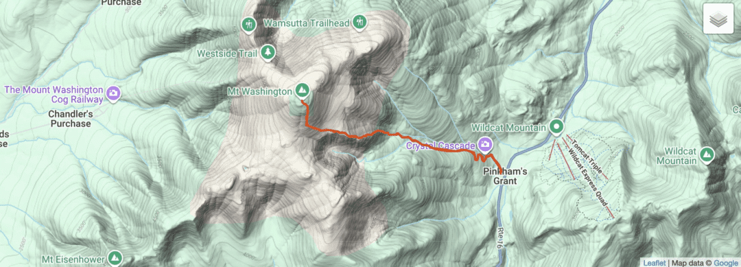
- Easy route to follow: As a “leg burner climb,” you can focus less on the route-finding aspect with this trail, because it is straightforward to follow. Look for the conditions signboard behind the Pinkham Notch Visitor Center and depart from there (after checking the conditions, of course). Look out for the Tuckerman Ravine Trail sign. Follow the wide, rocky trail up to HoJo’s (the caretaker’s cabin by Hermit Lake) a little over 2mi up, where you’ll gain about 1,800ft. This is the most gradual part of the climb, and a pleasant intro to what is to come: the steeps. From HoJo’s you’ll ascend directly up into the ravine, where you’ll feel encompassed by quintessential Northeast granite, moss, and sneaky waterfalls in and around the trail. Powerhiking mode engaged, you’ll blast up 1,400ft in less than a mile, and emerge above treeline. From there, you take a skier’s right-hand turn and continue about .5 to the summit up a playground of rocks that require your utmost attention and presence. 4,200ft and 3.8mi later from Pinkham, you’ll reach the summit, where you may have to compete for your summit sign selfie with the array of people who have taken the Cog or their car up. There’s the opportunity to refill water or grab a snack here before descending the same path as the ascent, or choosing another variation. You could take the Cog down if you really wanted to focus on the climb and nothing else, but the Cog pops you out at a different place than your Pinkham Notch start, so there’s more logistics involved there.
- Winter Visualization: The route to HoJo’s is the same as the winter ski route. What better way to dream up some winter adventures than to put one foot in front of the other on the same terrain that you soon will be skinning up?! The curiosity and feeling of really seeking to understand a place in all its seasons is unparalleled here—when looking up at the ravine.
Stats
| The Metrics | Tuckerman Ravine Trail to Mt. Washington Summit |
| Trailhead | Pinkham Notch |
| Summit | 6,288 ft |
| Distance, one way | 3.8 miles |
| Distance, round trip | 7.6 miles |
| Vertical gain | 4,247 |
| Average grade, whole climb | 21% |
| Descent options | Reverse the route, loop out via Lion’s Head, Boot Spur, or continue into the abyss of endless mountain adventures that the Presidentials offer. |
| Season | June – November, then ski it. |
| Cost | Free |
| Water | Filter from the streams going up the ravine, and there is water at the lodge at the summit. |
| FKT Up/RT see Links | https://fastestknowntime.com/route/mt-washington-nh See “ascent from Pinkham Tuckerman Ravine” and RT same |
Climb #2: The Local—Cranmore
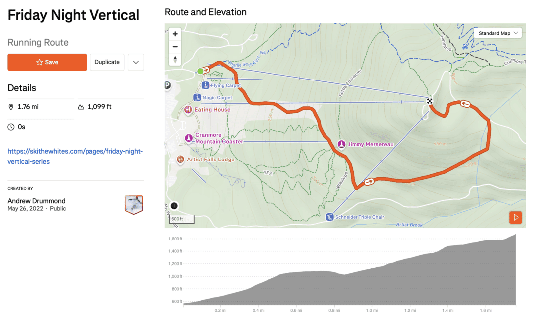
Mt. Washington is known for some of the fastest-changing weather and highest wind speeds in the US. So what do you do if you need your uphill fix, but there are 60 mph gusts above treeline? Cranmore. Look no further than the local ski hill out of North Conway. From May – July, the local shop, Run the Whites, puts on a hill climb every Friday, known as a FNV (Friday Night Vert) on this hill. People of all speeds are welcome at this group run; some race the climb, some hike, all enjoy the views at the top before descending at a chill pace and eating pizza at the bottom. Guaranteed good time and a way to share the stoke with like-minded individuals. The climb is 1.8mi and 1,186ft, and it’s a great option if you are short on time and need a leg burner. There is more than one way to ascend and descend this mountain, but I’ve chosen to focus on the FNV route because it’s the most well-known to locals and has a little bit of everything: rocks, single track, double track, and views.
Stats
| Metric | Cranmore Mountain |
| Trailhead | On the far left side of the mountain there is a large parking lot, by North Chair Road. The segment starts before the Lookout Triple lift, near a small lodge. |
| Summit | 1,671ft |
| Distance, one way | 1.8mi |
| Distance, round trip | 3.6mi |
| Vertical gain | 1,186ft |
| Average grade, whole climb | 12% |
| Descent options | From the top, you can see the bottom where you came from, so you could bomb down really anywhere and end up where you want to be. Or, you could take the fire road to the base, or even download on the chairlift and rep it, if you are in the window from 10am-4:30pm from mid-June to early September. |
| Season | June – November, then get your skis on. |
| Cost | Free |
| Water | Can fill up at the lodge at the base. |
| FKT Up | https://www.strava.com/segments/31909866 |
| FKT Round Trip | None |
Leave a Reply
You must be logged in to post a comment.