
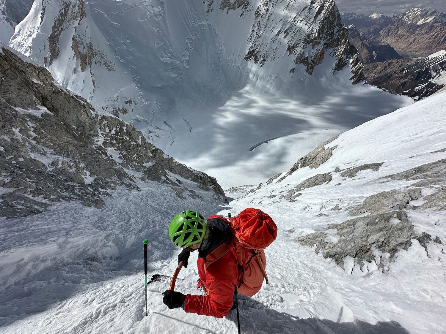
This past spring, Billy Haas spent another season guiding on Denali (along with a personal trip into the Alaska Range for a ski descent). Although Haas has guided Denali many times the traditional way—with clients walking, not skiing—this season, he and Adam Fabrikant guided two clients on a ski descent of the mountain. Up until recently, the National Park Service (NPS) did not permit ski guiding on the mountain. That policy has changed recently; the NPS does allow clients to be on skis both ascending and descending under the right circumstances. Read that as with the right guide/guides. With many seasons spent guiding (and personal trips) in the Alaska Range, Haas has observed what many have witnessed: Denali has increasingly become a skier’s mountain. Those flying onto the Kahiltna plop onto the runway, intending to wear touring boots for the duration, with the goal of riding specific lines or off the summit.
This summer, as part of a larger project exploring the evolution of expeditionary skiing and riding, we connected with Haas, a THR founder/contributor, to discuss certain aspects of the big mountain scene. In part one of our conversation, we frame what Haas refers to as a mindset shift when thinking about and entering bigger, higher, and potentially more extreme mountain environments.
A Shift in Mindset
Billy Haas: When we talk about Denali or some other big mountain setting, we can obsess over the checklist items during the planning process, such as camping supplies, food, and logistics. They are all important things. But they can sometimes detract from the real work of a mindset shift. I’ve seen it countless times, there’s a disconnect for some people who struggle with shifting their mindset from skiing in the Wasatch, or the Cascades, or the Tetons, and then all of a sudden they’re on a big mountain. The key is how you apply concepts that you’ve used and lived by as a winter powder skier or rider to a big mountain setting, while simultaneously keeping it aligned with your risk-management thresholds.
THR: You jumped right in there. Let’s define something for readers, because it is a term thrown around quite a bit. And for fear of sounding clueless, I do think the term “big mountain” needs some clarification. It all seems relative. I think what you are getting at when you or others use “big mountain” to describe a mountain, or an alpine theater in general, is the idea of scaling up, where everything, not just the mountain, is bigger.
So, back to basics here. Contextually, what is big mountain skiing or riding beyond a fancy way of selling a ski mountaineering course, or likes, or letting folks know you’re getting rad?
Haas: “Big mountain” can be a nebulous term. Take someone like me. I came from the East Coast. Initially, the Wasatch felt pretty big. Scaling up a degree or three, coming from the Wasatch, Mount Rainier felt pretty big until I spent a few seasons guiding there. Yes, it is a sliding scale. However, when I think of a big mountain setting, I would contextualize it as more remote and expeditionary in nature, meaning several weeks or more in duration, likely at high altitude, and with more complex weather conditions.
In my opinion, the most important variable when moving into, or actually defining, a big mountain setting, is the lack of available information. This “information desert” is what really differentiates your standard winter-powder scheme in known ranges.
I think the information I’m considering is two-fold. There’s the beta, which includes the basic logistical information, such as time, place, and situation. The type of background one gathers from guidebooks, documented ski/ride runs, and climbing routes, as well as more granular information, such as known descent points and rope lengths for technical descents.
Then there’s the real-time information: telemetry data from weather stations and snow sites, avalanche forecasting, and observations. You lose all of that in a big mountain, more remote setting. Once on the ground, it’s up to you and your team to gather that data. It’s critical to approach this data-poor environment with the understanding that you may never have all the data. And you need to understand, no matter where you are from, whether it’s the Tetons, Wasatch, Colorado, Washington, Oregon, places that have avalanche centers, even avalanche centers that don’t have many observations, that’s still a lot more information than you have access to in a big mountain setting. You’re going from your standard winter operations, or home-range operations, likely a data-rich environment, and you’re now moving into a very data-poor environment. And that’s a huge shift. I think that’s something that throws people off.
THR: I think it’s an obvious question here, and then we’ll take a step back. Denali, especially if you’re skiing/riding based out of 14k camp, granted, it’s still a big mountain environment, but one where there is some data availability. There are scores, if not hundreds of people, bantering about conditions, weather forecasts, future IG posts, and there’s an NPS patrol stationed there. In the context of what you’re describing, I suppose there are good reasons for people misjudging it, or they’re not prepared for it because there is some data. And being in close proximity to other people also has the effect of some real (rescues are more viable) and false sense of security.
Haas: Well, you have some data, and so take something like 14, and we’ll have to walk this back in a second, because one of the pieces of knowledge I’m thinking about is that you’re moving through a range of snow environments on a mountain like Denali. There’s a variety of snow ecosystems, and they often don’t fit into the typical definitions of winter snowpacks with which we are most familiar, such as maritime or continental snowpacks.
Denali, on the whole, whether you’re at 14 camp or wherever you are on the mountain, you’re still somewhat isolated from acquiring useful data beyond your reliable friend messaging in weather forecasts. There is no organized seasonal history considering snow or weather—all the things we would normally access and mull over when making our terrain decisions back home.
There is some information coming mostly in the form of observed avalanches, observed snow pack characteristics, and weather. But you’re getting a snapshot. The season on that mountain starts in early May and lasts through early July. At most, your inputs are two and a half months of information. Much of that information isn’t transmitted from group to group; it remains isolated, with no central avalanche center to analyze and disseminate the information.
Those intent on skiing/riding Denali need to approach the mountain with a data-poor mindset. And the caveat there is this: When you have mountains prone to massive weather events, the snowpack can be rearranged in a single storm. What happens in early May may not be applicable to early June, where, perhaps in other mountain ranges you’re used to operating in, information from a month prior can be somewhat useful. In a place like Denali, you’re forecasting more from storm to storm, not from month to month, or throughout the climbing season.
Let’s re-center a bit. This may sound obvious, but it remains challenging to be fully present and understand a problem-solving framework that requires adjustment. One of the most important things is to gain a high-level understanding of where you are and what you’re trying to do. Denali is a great example. With a 13,000-foot relief between basecamp and the summit, there’s a massive range of conditions in each elevation band. What you observe at 7,000 feet on the lower Kahiltna tells you nothing about 14 camp. Just right there, that’s a 7000-foot elevation change. For those Wyoming-based tourers, that’s an elevation change equivalent to the Bradley Taggart parking [the starting point for most Grand Teton ski missions] to the top of the Grand Teton. Conservatively, we’re talking about three different worlds regarding weather, snowpack, and so on.
As skiers and riders, no matter where we are —be it big mountain or home terrain —I think that when we approach avalanche terrain or steep slopes, areas where we are exposed, we take stock of our position and begin to understand the potential hazards we may be susceptible to.
There’s a chance, for example, that you could be down at 7,000 feet, and if you’re standing underneath a massive wall and it’s warm, you’re likely thinking about wet snow problems. But that doesn’t mean you couldn’t have really significant dry snow avalanche problems building above you. The key is to understand that there’s a lot more dynamic change considering where you are and where you’re trying to go. That’s an issue I see quite often with people, where they’re looking around and making general assessments. This is because we’re trained in winter to make these on-the-go observations from our avalanche classes. It’s all a reframing of the scale, and not making assumptions about conditions above as the elevation ranges on a big mountain are, most often, much larger than what we’re used to operating under.
THR: Give me an example of someone making an assessment lower down, in somewhat safe terrain, and terrain that does not really present anything remotely adjacent to the day’s avalanche problem. Illustrate how they may be missing the context of scale—those large elevation ranges and the different problems/conditions that may be present.
Billy: Here’s an example. People poking their poles and in the snow down low in the forest, looking for some kind of anomaly in the snow. Getting a sense for the snow is not the issue; it’s that the data is nonexistent to poor when the tour plan doesn’t call for entering avalanche terrain (or at least in close proximity to it) for another 2,000 feet or so of elevation gain.
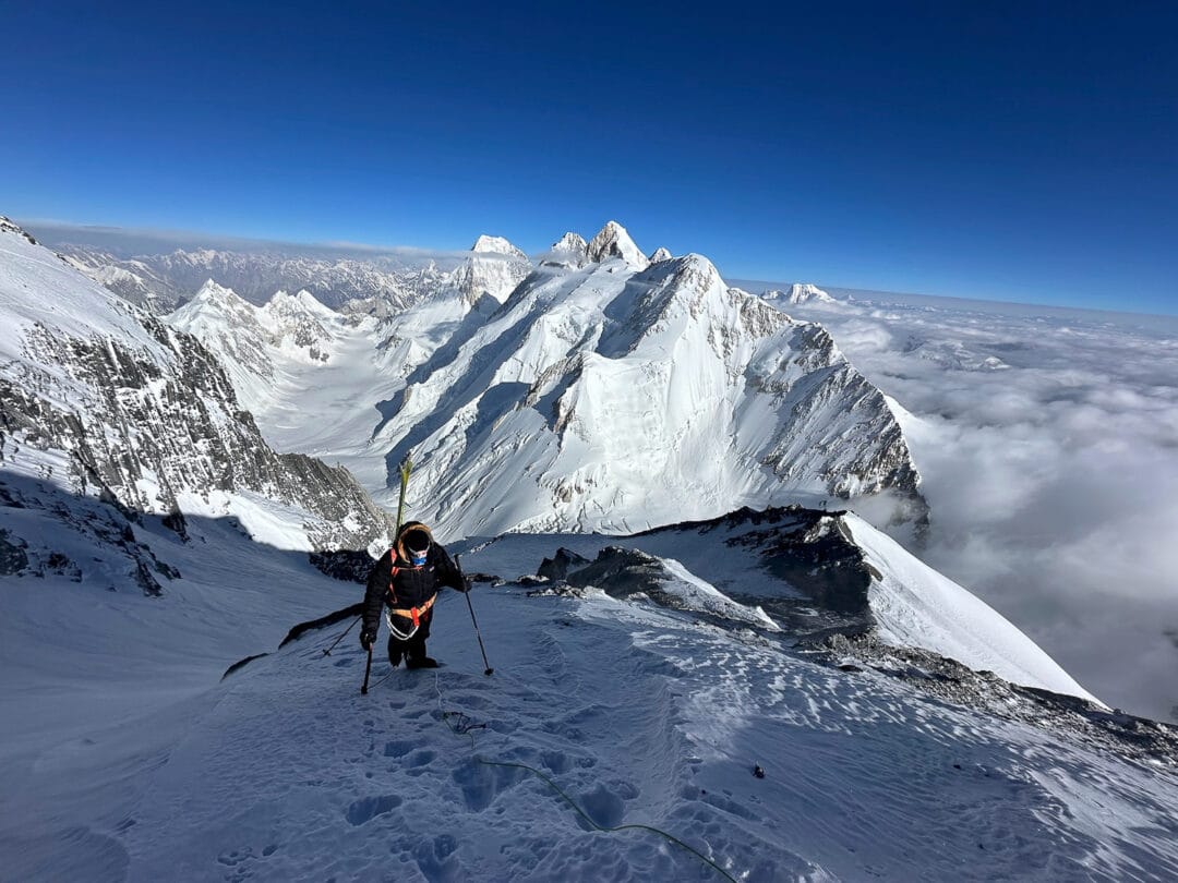
THR: What about Denali? If folks are ascending the standard route, I assume they do not start thinking about snowpack instabilities (or even serious overhead hazards) until maybe 10,000 to 11,000 feet.
Haas: Right. On the standard route, you don’t really need to zero in on potential avalanches until about 11 Camp.
To be clear, I’ll be thinking about some things regarding the snowpack, but I’m not going to have my avalanche brain on until higher up on the mountain. There’s always going to be avalanches ripping off Mount Hunter. Basically, you’re always going to see things falling off. Again, that’s not a telltale sign of what it’s going to be like higher up. It’s essential to wait until you arrive and then begin making assessments, or when you’re in the avalanche terrain. I’m not saying to be ignorant or oblivious. I’m saying to focus on where you’re actually trying to ski and will be exposing yourself to hazards.
I’ve seen wall-to-wall windboard at base camp. And then you reach the actual avalanche terrain above 11,000 feet, and it’s perfect powder.
Another point about the mindset shift is to also understand when to rely on your prior experience. Snow is snow. I recall people asking me, “How was the snow different on Gasherbrum I and Gasherbrum II?” Beyond the high altitude, it was the same facets and wind board I’d skied elsewhere. Just because you might be in the Karakoram or on Denali, if it’s windboard, it likely will present similar characteristics to the windboard you have skied in the past. Snow on Denali, or any big mountain, doesn’t mean it’s any different, for example, than in the Wasatch.
Just because you’re at 16,000 feet on Denali, if you see certain weather patterns there at 16,000 feet that present like a wind slab hazard back home, treat it as a wind hazard.
I’ve seen a few of the avalanche accidents on Denali that are in close proximity to the West Buttress route. It is big mountain terrain, but for some reason, some people feel like it’s going to be different. For example, if it snows a foot and is blowing 35 miles an hour, you will likely encounter wind-loaded slopes. Heed caution. You have likely seen the same conditions back home, so don’t keep walking up into that wind slab. The rules don’t change, per se, just because you’re in this other type of environment.
THR: So, you’re seeing people overthinking it, and they’re like trying to maybe solve for problems that aren’t there? I’m just trying to wrap my brain around someone who’s in that environment, and it’s windy and snowing, and the known and unknowns were evident.
Haas: I think it’s both. I think they’re overthinking and they’re underthinking. I think there’s sometimes an inability to operate independently outside of an avalanche center’s forecast. Which comes full circle. In a big mountain context, the rules of engagement mean there’s a big amount of independence, if not total independence, regarding key benchmarks like snow stability, weather forecasting, and when and how to move up or down a mountain. Certainly, there’s something scary about being unleashed like that. But there are huge rewards. It’s about coming into these environments with solid skills and a team you trust to make assessments—or, to keep this all on track, to fill in the data gaps with data (though observations and experience) you’re collecting in the field.
Leave a Reply
You must be logged in to post a comment.