
Avalanche terrain: a skin track and skier on the left, a hefty crown and debris to the right.
Glued to your phone. Despite our best intentions, it happens in the backcountry too. Take the steps, find balance, and embrace your fully formed mountain sense.
Get off your damn phone in the backcountry! But also use it; it’s such a great tool. Confusing? Welcome to a moment of zillennial madness while I repeatedly get on and off my high horse regarding technology use in the backcountry with a slew of opinions you may or may not share.
It’s 2024. We have the most resources we’ve ever had for backcountry skiing, though AI hasn’t quite made it into the field yet.* In general, more information is a good thing. Perhaps you are pissed that we youngins are taking over your secret powder spot or that there are too many jerrys out there. No person is more or less deserving of sliding on snow, and with all the shenanigans going on in the world, it seems like anyone who has the privilege to be able to take a moment to be outside in winter should feel empowered to do so while we still can. Regardless of how you feel, we can’t escape these truths: resources are at our fingertips, and way more people are using them to access the backcountry than ever before. While I’m pro-access, I am concerned that we are losing our mountain sense.
What is Mountain Sense?
Mountain sense is intuition. It’s a connection with the elements. A conscious layering of our assessments of multiple risk factors simultaneously in critical moments and an innate understanding of a mountainscape at any moment. It’s more than the lines you’ve skied, the avalanche courses you’ve taken, or how fast you are on the skin track.
I’m a generational cusper. My first forays into the mountains were with older mentors before smartphones were commonplace and when having a good head on your shoulders mattered more than getting the shot for your followers. I was lucky to have that access at an early age, and I recognize that many folks don’t start seriously going into the mountains until their twenties, thirties, or beyond. As someone under thirty, many of my peers are newer to acquainting themselves with the mountains, and I see them using the tools available to them but only sometimes keeping their heads up as they seek to find their way. This feels especially true as I sense folks shying away from mentoring others in the spirit of pursuing individual goals (I don’t know if that is a real phenomenon, but it feels like it is).
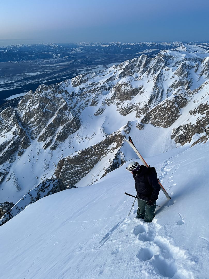
Mountain sense engaged—Slator Aplin and dawn in the Tetons. Photo: Aidan Whitelaw
A Test of Sorts
In particular, over the past few years, I’ve seen our reliance on slope angle shading grow. Don’t get me wrong, it’s a phenomenal resource AND I worry we don’t consider other factors enough and/or experience tunnel vision. Many remember the Silverton avalanche incident during a CSAC course in 2019. In my circles, this moment cracked open the conversation of reliance on this data and its shortcomings. Many people I know began to critique “pixel pinching,” i.e., trying to skirt a line to narrowly avoid “avalanche terrain,” i.e., slopes greater than 30 degrees. But sometimes, I see those same people falling into the trap themselves.
Then, this year, we learned more about inaccuracies in slope angle measurements via Ian McCammon’s paper Slope Measurement for Humans: Inclinometer Error and Risk. There’s a great write-up on that paper on the High Route already, so I won’t focus too much on the content, but I would emphasize that we (yes, even you) aren’t great at measuring slope angles, and frankly, neither is technology. This is especially true on the edges—where slope angle changes. Anecdotally, this is the same spot where I see people heavily relying on slope angle to “avoid” avalanche terrain.
I was recently teaching an intermediate avalanche course and was reminded how much folks want to rely on slope angle. My co-instructor led an excellent exercise where she had folks look at the Avalanche Terrain Exposure Scale (ATES). It includes slope angle, slope shape, forest density, terrain traps, avalanche frequency, start zone density, runout zone characteristics, interaction with avalanche paths, route options, exposure time, and glaciation to help classify avalanche terrain into three categories—simple, challenging or complex. They were instructed to pick the top 3 factors to decide if the terrain could produce an avalanche. There wasn’t much consensus until it came to slope angle. Everyone chose slope angle as one of their main factors for classifying terrain. Recently, Onx Backcountry sent an email titled “Slope Angle is the Most Paramount Backcountry Ski Tool,” promoting their slope angle shading. I’m not saying slope angle is something we should ignore. Still, I think there can be an overemphasis on slope angle that is both dangerous and ineffective, especially as folks progress beyond Level 1 skills.
So, with slope angle both being inaccurate and only a slice of the pie, where does that leave us? Hopefully, we will hone our use of technology to be more holistic, use other parts of ATES in addition to slope angle shading, and remember to pull our noses out of our phones and use all of our senses, including mountain sense.
I suggest experimenting with using technology as a tool at home and then keeping use somewhat limited when actually in the mountains. Of course, this may take time to feel comfortable doing, especially in new areas. I’m pretty excited to explore more of Onx’s ATES map layer and hope that will help people begin to see nuance with slope angle, but I fear that here we may see a similar over-reliance on technology.
In many ways, I’m jealous of the oldies who didn’t have as much information to sort through. It’s so neat to really get to know an area. To visit the same place many times in a season, in different conditions, to leave the phone at home, and explore with our eyes and maybe a topo map (I LOVE topo maps) vs. doing a lot of research to find the sickest line and then gluing ourselves to the GPX track. You should try it. Learn a place really well without much planning. It could be a basin, a drainage, a mountain, or even a whole range, depending on how much time you commit to it, but finding that intimacy with place is part of what makes winter time so special. I enjoy ignoring where the skin track is “supposed” to be; it provides a learning opportunity to figure things out by myself. Start small when visibility is good, and do a mellow recon mission to get data. Take your own pictures, think about what clues tell you about avalanches, use ATES to classify slopes on your own, and write down what lines you want to ski and what conditions you’d need to see to feel confident in those choices.
And, if you see me out there, make sure to tell me to take my own damn advice!
*I DID, for funsies, try asking ChatGPT where I should ski today, and it kindly directed me to my local avalanche center or told me to ski in bounds.

Good reminder, thanks MoCo.
“I sense folks shying away from mentoring others in the spirit of pursuing individual goals (I don’t know if that is a real phenomenon, but it feels like it is). ”
I say show me an actual youngie that wants to do more of what you describe in your last paragraph and this oldie would consider being a mentor to them. BUT, a speaker hanging off the pack and a kicker built in the middle of a classic powder shot receives less understanding from me. At the very least, I do mentor my own kids at the art.