
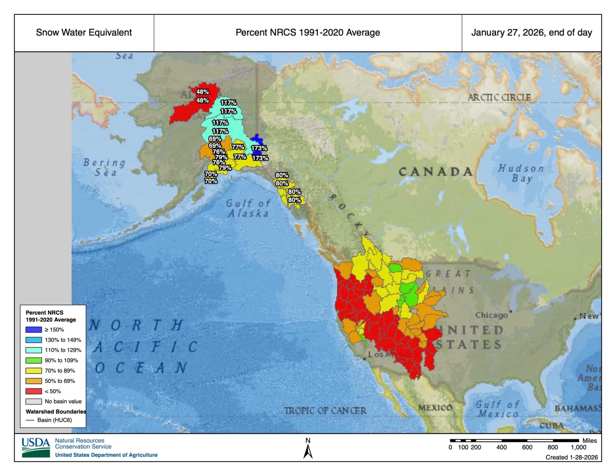
Alerted by the Utah Governor’s call to action yesterday, Cox calls for prayer again as Utah’s snowpack nears record low, reads the KSL.com headline. Cox is quoted as saying, “We know that when people of all different faiths and backgrounds join together and plead for help from a higher power, remarkable things can happen.” Regardless of your spiritual preferences and anyone’s ability to align their chakras and impact widespread weather patterns, snow dancing aside, maybe Governor Cox has a point.
In all seriousness, as many know, as this historic drought continues, currently manifesting in a lack of snowfall, there’s more at stake here than simply sharpening your edges. With a bit less than two months before what most historic indices mark as peak SWE, from a moisture perspective, things look mighty grim in the western U.S. Expect more calls to prayer and more alarm from those dealing with potential wildfires and water-use restrictions in the coming months.
But,…we’re here for the ascent and the turns. Thinking of smile quotients, many SWE totals at the higher elevations are trending toward normal. Which means ambitious folks can find proper riding. Further, across the region, high pressure has generally been locked in, with little to no snowfall (except for the recent dump in Colorado—it looks like Crested Butte received upwards of two feet of snow). With our collective ears to the ground, with stable avalanche conditions, it’s our understanding that many ski and board tourists are doing their due diligence and finding what they need to make a go of it this winter.
But here’s the trigger warning: If you have an adverse reaction to the color red, or red-adjacent colors (orange/yellow) for any reason, maybe now is the time to turn away.
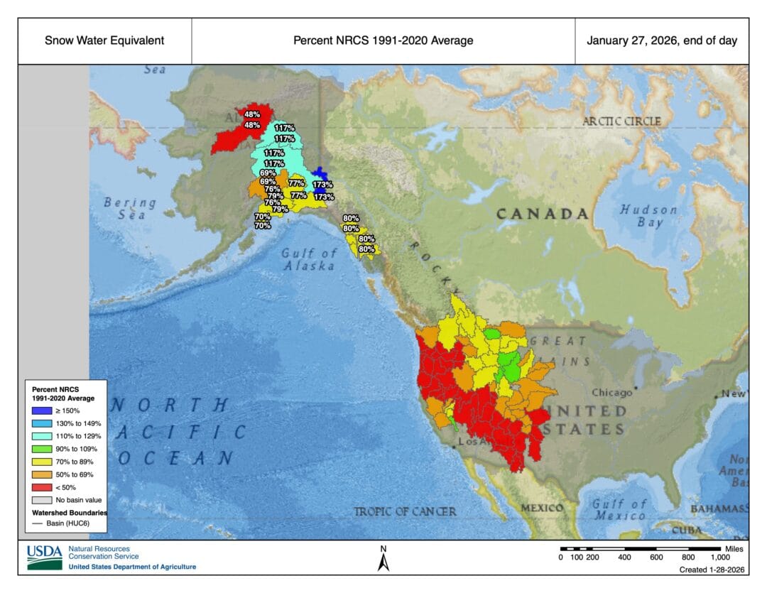
Ok. So maybe not too bad if you’re not a rancher, farmer, or salmon or trout, but for those of us looking for less than teeth-chattering conditions, the colorways represented above ain’t pretty.
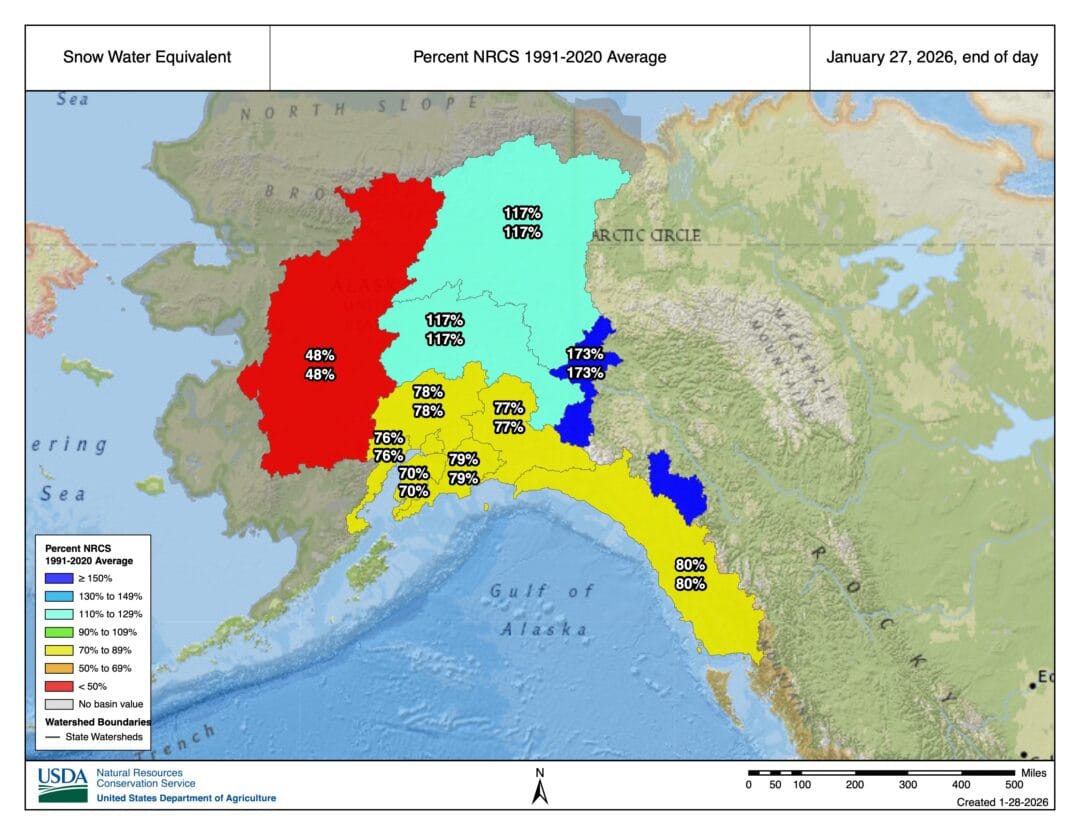
Up to the home of spines and real good sockeye: AK. A mixed bag, certainly. The coasts remain in the 3/4-full department, while the central/interior ranges look bleak, trending toward Russia. In contrast, moving toward our friendly neighbors to the east, in Canada, looks more promising.
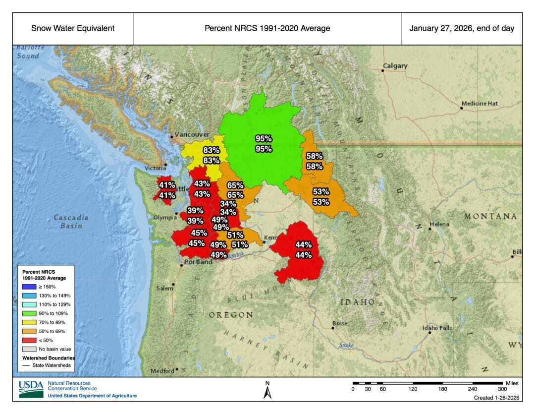
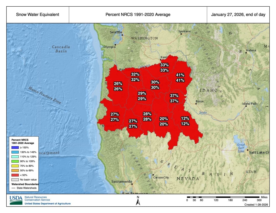
Down in the Lower 48, Washington and Oregon present slightly different narratives. A closer look at Washington reveals a barely-hanging-in-there situation. Ranges closer to Puget Sound are suffering, while pockets here and there in the central and eastern parts of the state are improving—barely. Oregon, on the other hand, looks downright dessicted. We know some people there, and that place is pretty desiccated. While the warmer-than-normal temps and sunshine have softened southerly aspects for some midday corn, expect auditory sensations more akin to ski edges side-slipping on a water-impregnated World Cup course.
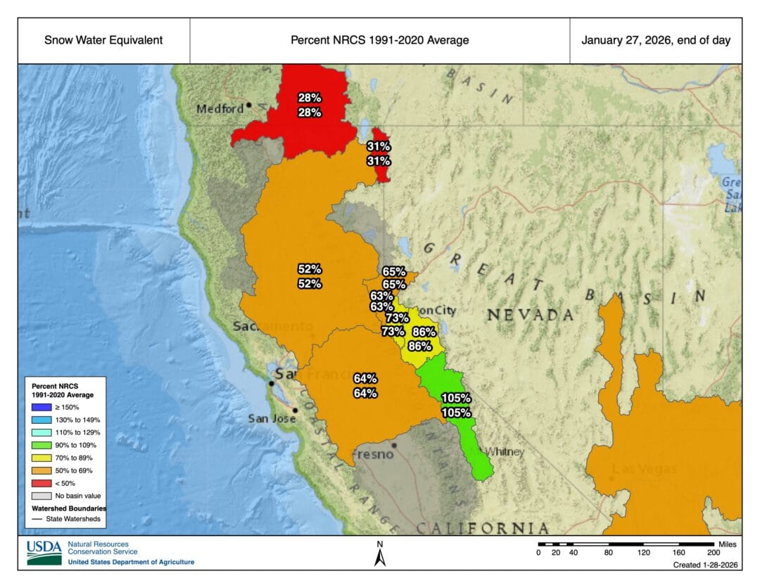
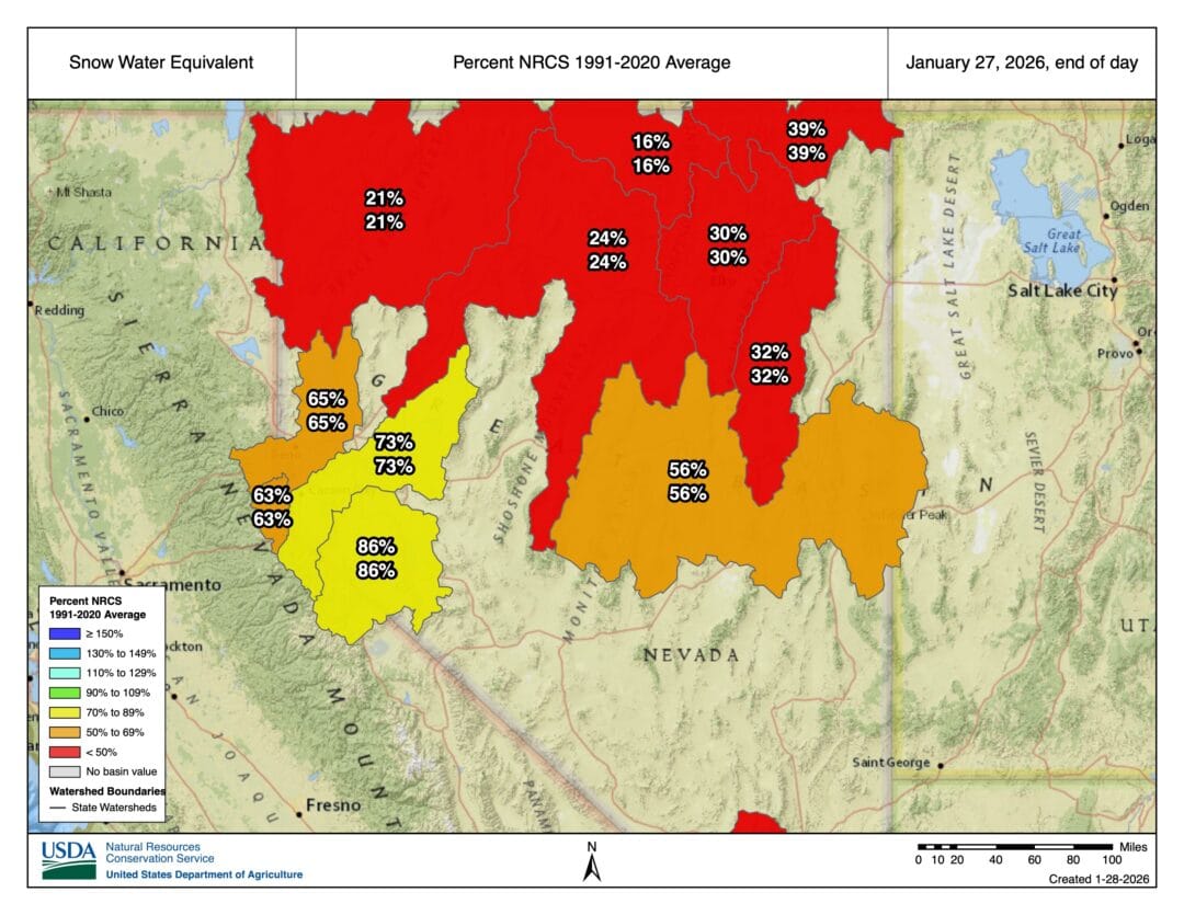
The story in the Sierra, and further afield into basin and range country (but damn, Nevada is mountainous), is also one of salty tears and sorrow…for the most part. This is one of those stories where we hope, as the narrative arc unfolds, that better things and turn-potential, are on the horizon.
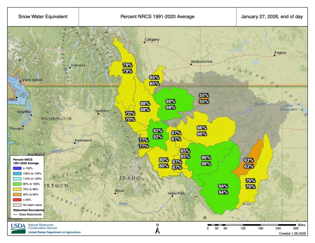
A month ago, we compared Idaho to a bag of Skittles, and we are sticking with that analogy. Ok…if just beyond fifty percent is your thing, then the pan handle might deliver. Whereas the central and eastern portions of Idaho are better positioned as we exit January.
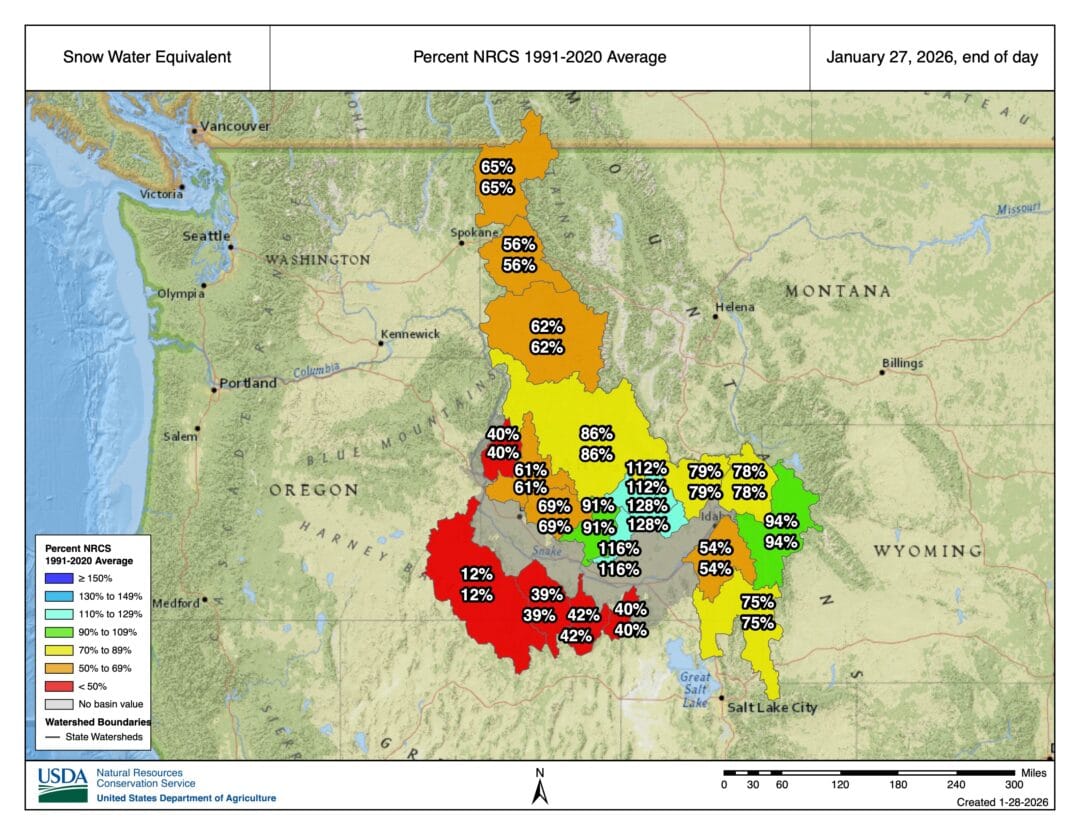
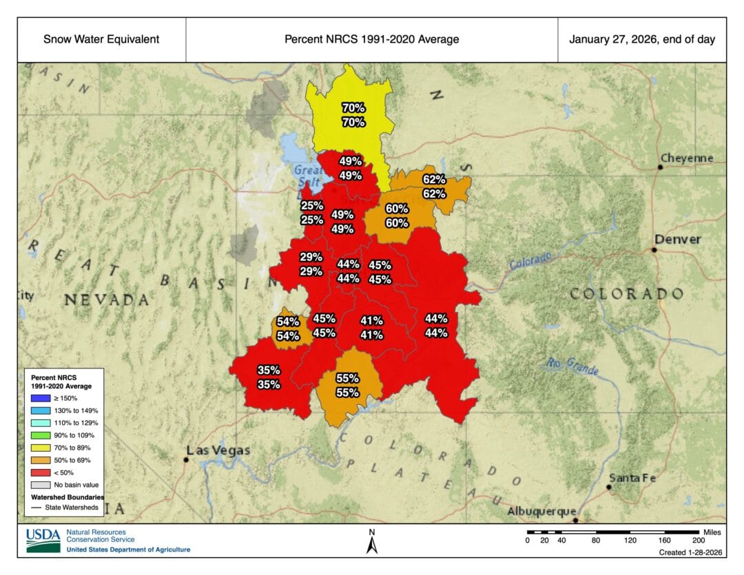
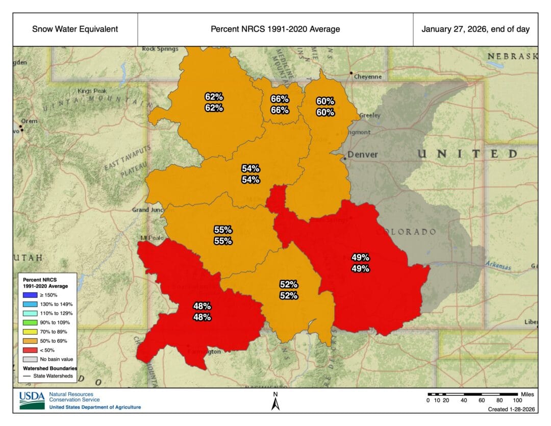
We suppose now is a time to remind readers that we are using SWE maps that illustrate state-specific water basins. In other words, the percent SWE is based on a series of SWE measurements, including data from SnoTel sites. You might go out and about in a very specific zone and find better conditions than these broad, pulled-back views. Furthermore, if you seek colder and less sun-affected aspects, you might find yourself enjoying some deep surface hoar to remind yourself that powder skiing (remember that?) is a ton of fun. Although we already mentioned this, some of the SWE data affecting the broader basin-wide percentages are impacted by near, at, or above averages in the higher alpine zones. (It might be deeper than you think up there.) Although snow in those places, and especially those impacted by high winds, may present some gnarly variable conditions. But snow is snow, right? The upside here to any potential downside, and the downsides are considerable, is that mid-winter’s low-angle light is very kind on the eyes and can make for some lovely views.
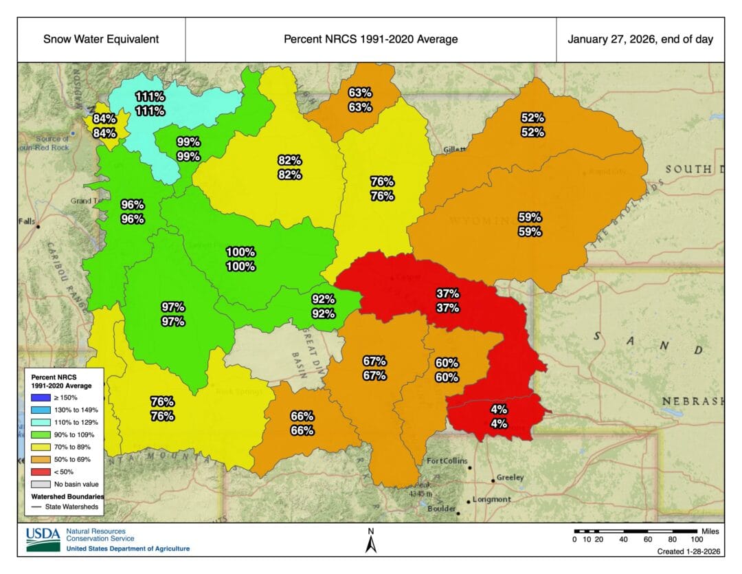
There are atmospheric stories going on below in Utah and Colorado, respectively, that aren’t totally happy ones. No matter how you look at it, the Greatest Snow Earth or the Rado’s Rocky Mountain High, none of it is promising. Snowpack, for both states, provides much of the water supply. Yup, it’s not all figure eights and wiggle turns.
We suppose everyone has seen enough of the West. In the East, it is an entirely different snowglobe. Further, our access to data and visual representations is quite different. All the above images are from the Natural Resources Conservation Center and the National Water and Climate Center (science is good!), while the data we are using for the East Coast is different and comes from NOAA and the National Weather Service.
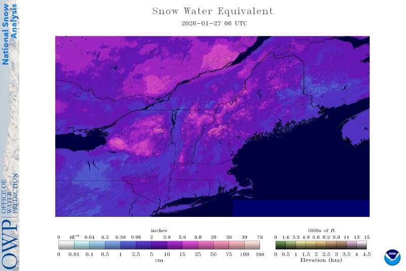
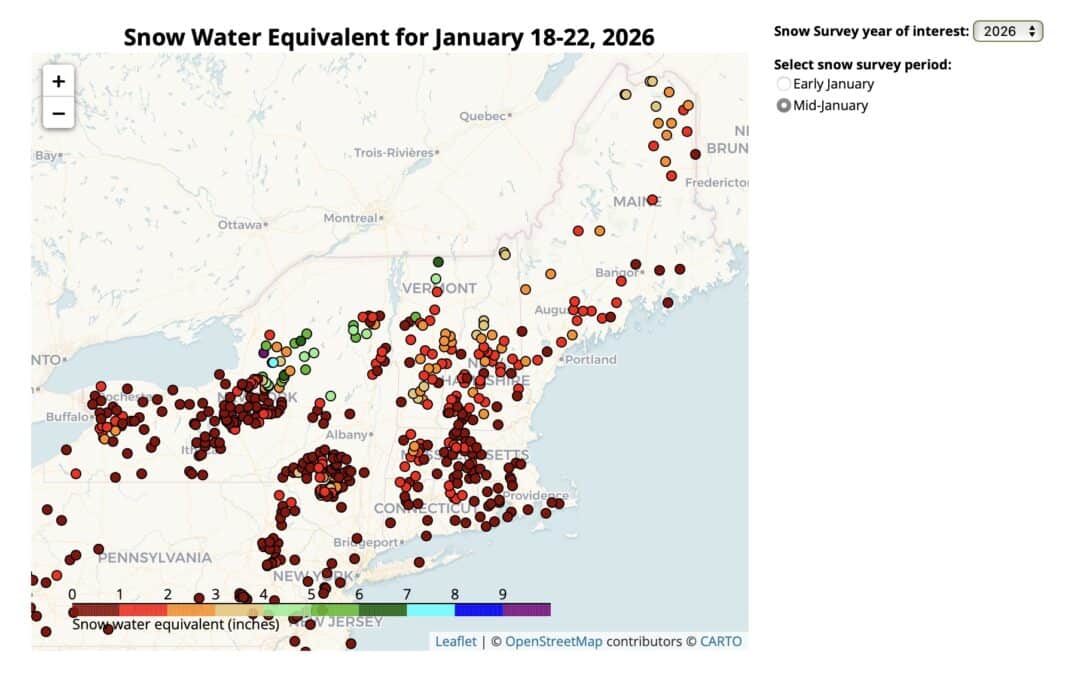
No matter how you slice it, the East is less reliant on snowpack for its water needs. That said, the fine season in places like Vermont, New Hampshire, and Maine is evident in the image above. We do recognize that climatic and daily conditions can change drastically in this part of the world. And to close this out, we’ll be looking at the snow conditions up in Canada early next week.
Leave a Reply
You must be logged in to post a comment.