
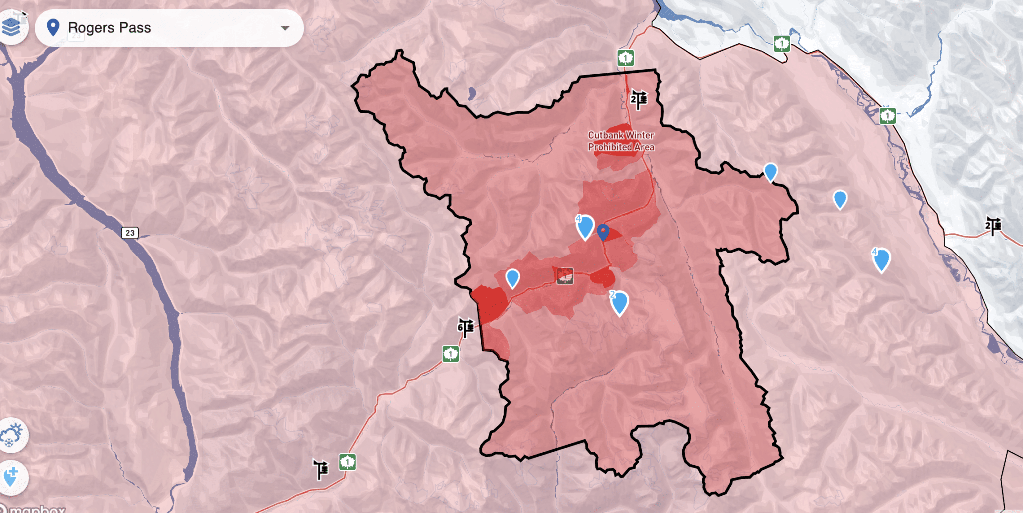
Keeping an eye on a snowpack way, way, way far from the PNW, Bozeman, SLC, etc., has its usual pitfalls, other than the basic lack of proximity. In the run-up to a trip up north next week, our group has been working connections—people who know people who know people—reading AV Can MINS reports, and hearing about very spooky PWLs from every which way.
Not to say this is accurate in any and all locations up north, but the State of the Snowpack, Revelstoke edition from March 19th, listed out the following layers of concern:
- Jan 26th Surface Hoar/Melt Freeze Crust/Facets
- Feb 7,8,9 Surface Hoar/Sun Crust/Facets
- Mar 8 Rain Crust up to 2000 meters
- Mar 15 Sun Crust on Solar Aspects
- More recently, Moist/West Snow up to ~2200 meters
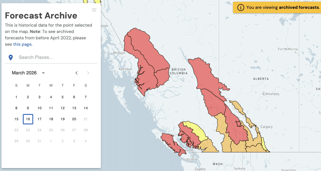
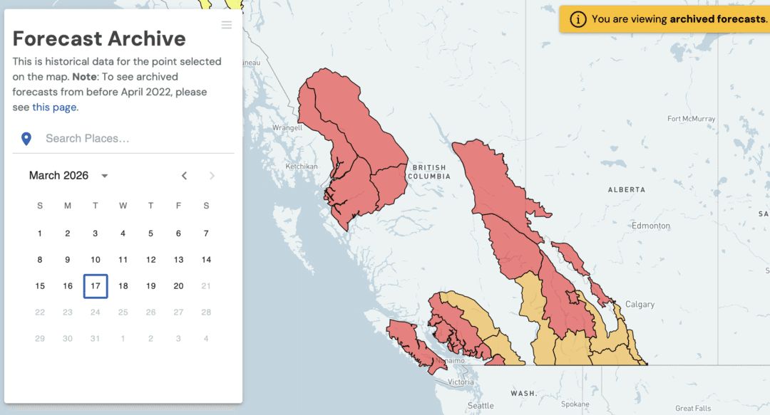
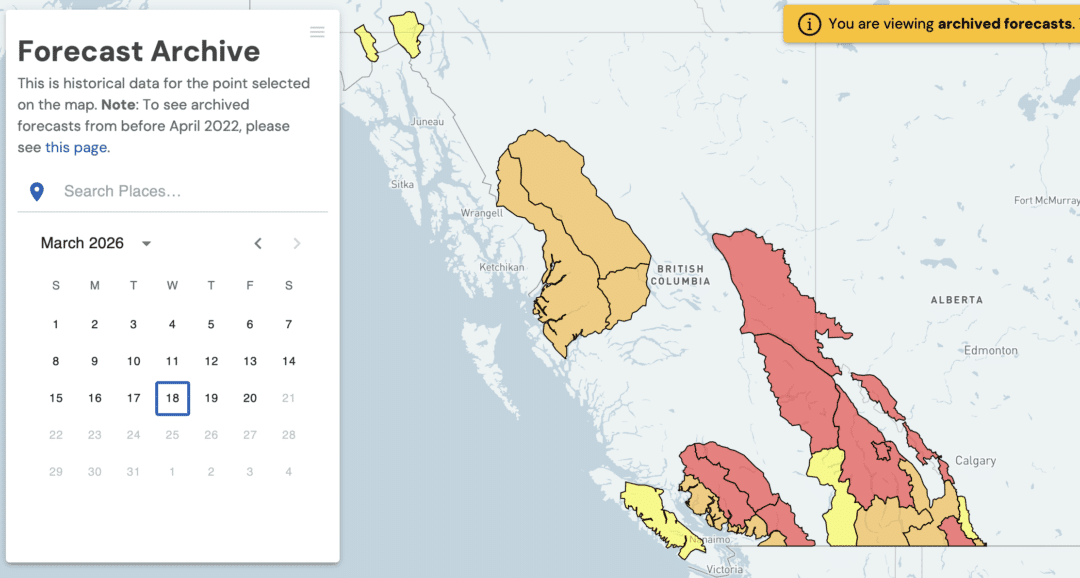
The basic facts are that, seemingly, the entire western provinces of Canada had considerable to high avalanche danger this week. Again, from a distance, with zero feet on the ground, there’s enough information for us to proceed with extreme caution. At least that is our MO for the foreseeable future. (Below, screenshots from AcCan’s archived forecast.)
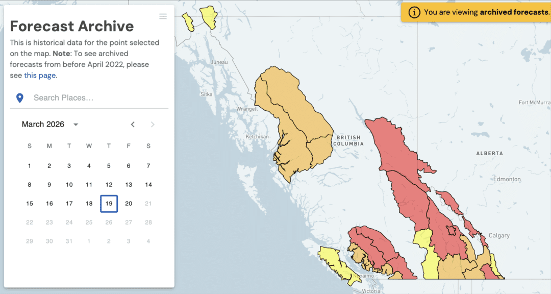
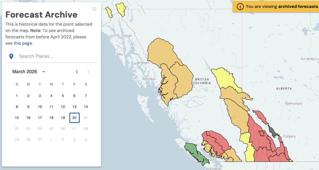
So, what are we all here for? In this case, it is not the turns or reading about turns. Let’s think of this as more of a traditional learning experience rather than something more experiential. We are not going out and digging pits. We are, however, listening to folks who have been guiding and forecasting in and around the Revelstoke zone. Linked below, as referenced above, is the March 19 State of the Snowpack brought to you by…State of the Snowpack, which has the following mission statement:
The State of the Snowpack (SOTS) is a BC Public Safety Society passionate about empowering backcountry recreationists with local-as-it-gets snowpack information on a community-by-community basis so that we can all return home from the winter backcountry safely every day.
Alongside Avalanche Canada’s Regional Avalanche Forecasts, State of the Snowpack’s Live Event in-depth snowpack updates, and our short-form video snowpack updates serve as other tools in the toolbelt of decision-making for backcountry recreationists!
State of the snowpack discussions go down in the U.S., too. And it’s never not a good time to thank forecasters, guides, and those among us who provide observations, for their great work. Also, and perhaps more to the point of this short post, the State of the Snowpack below does an excellent job highlighting the dynamics in play when heavy, copious, and wet snow (and rain) fall across mountains and valleys blanketed with a touchy, stubborn, wicked, and any other term you want to throw in there for good measure, snowpack. Thanks for your work! You don’t need to be heading north to learn something from this discussion. At a minimum, you’ll see images and hear about some rather large avalanches.
The video is another data point and another way we can communicate as a community, so we are not necessarily staring down at our navels. The main presenter in the video is Ben Yeager (CAA Level 2 / ACMG Apprentice Ski Guide). Great job, Ben, for pulling all this together.
Leave a Reply
You must be logged in to post a comment.