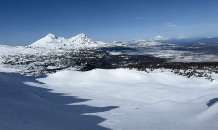
Eric Crater assessing the South Coast snowpack. Photo: Jack Casey
A team of two in Canada’s South Coast Range have a compelling newsletter—The Weekly South Coast Conditions Report—to assist those touring in the region to make better informed choices regarding the local snowpack and conditions. Which overall, should increase the fun factor.
It’s a small sample size, but dreaming abounds here at The High Route. Sure, we love our home ranges, but planning for and visiting new zones, particularly far away zones, helps with the motivation. Yet stepping foot in a place you’ve never skied, even with decent planning, is daunting. All of us check the local avalanche forecast—but having a “connection” with a local who gets out nearly every day is a luxury many of us don’t have.
Evan Stevens, an IFMGA guide, and Eric Carter, a full-time mountain athlete, are Squsmish, B.C. residents who have begun a noteworthy newsletter. The newsletter, Weekly South Coast Ski Conditions Report, is an interesting conditions-forecast model. The duo is out and about in the field almost daily, so their on-the-ground findings are of use to others looking for updates who may not have the ability to collect real-time information or, in other words, are stuck behind a desk, a keyboard, and any occupation precluding them from being in the conditions and forecast know.

Navigating South Coast glacial complexities. Photo: Eric Carter

Eric Carter and crew South Coast couloir skiing. Photo: Jack Casey
The mission, according to the newsletter’s website, “is to give ski tourers and ski mountaineers on the South Coast of British Columbia as much information as possible while making decisions around the best and safest places to ski!”
Canada’s backcountry is epically vast. As someone who likes to digest condition reports from afar without getting spoon-fed beta, I find the newsletter to hit a sweet spot. I don’t live in or around Squamish, but the newsletter does not appear to overshare with information directing the community to ski this or that powder stash. Further, Avalanche Canada’s geographic responsibilities are huge—all of Canada. And their forecasting products remain excellent. Yet access to a newsletter that gets granular about a specific region can be an asset. (I wouldn’t be surprised to see other professionalized newsletters/resources pop up in the future—it seems to be a fine way to supplement the information we can garner from an avalanche forecast and public observations.)
What follows is an interview with Carter to learn more.

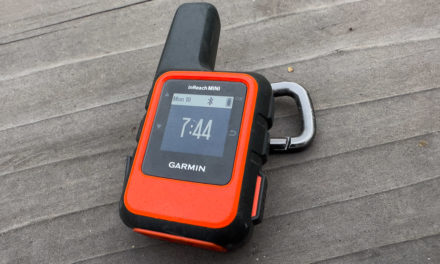
Evan Stevens in the booter. Photo: Eric Carter
***
The High Route: For those unfamiliar with backcountry touring/ski mountaineering around British Columbia, particularly along the coastal zones, please describe what you call the South Coast.
Eric Carter: The Coast Range of British Columbia extends from Vancouver to the Alaskan border, creating a spine of the province. We often split this large swath into the South, Central, and North Coast regions, but generally, folks referring to the South Coast mean anywhere from Vancouver to a bit north of Pemberton or roughly the Sea to Sky Highway Corridor.
Its proximity to Howe Sound characterizes the Vancouver to Squamish portion, the large fjord coming off the Pacific Ocean, and the steep North Shore Mountains rising straight from the sound. The ocean terminates in Squamish, where glacially formed peaks surround the sound, including the Stawamus Chief. These geographic features mean our primary weather pattern from the southwest comes from the ocean, accelerates up the sound, and slams into the first round of big peaks.
From there, the Squamish and Chekamus River valleys lead nearly directly north past Garibaldi Park up to Whistler and then further north and east to Pemberton. These valleys line up well for solid snowfall when arctic air dominates and rushes south, accelerating down the valleys toward the sound.
Furthest away, Pemberton has the Duffey Lake Road, a high pass towards the interior, and remains the only option to leave the area other than Highway 1 through the Lower Mainland. The Duffey climbs to over 1000m outside Pemberton and has numerous trailhead points to access ski touring.

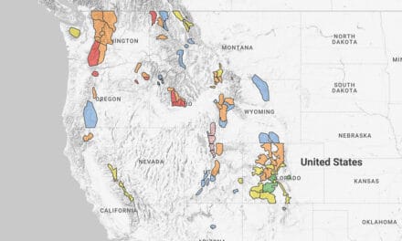
A Google Earth screen grab showing Squamish in the lower left, and Pemberton in the upper center.
THR: How would you generalize the terrain and snow conditions on the South Coast, and how might the snowpack differ from the other prominent mountain ranges in Western Canada? (For example, the Rockies.)
Carter: The Coastal snowpack is generally much warmer and wetter than elsewhere in North America. We are the first ones exposed to storms coming off the Pacific, which means more precip and lots of wind. The ocean also acts as a temperature moderator. Generally, in the winter, temps stay warmer (sometimes a little too warm), and in the summer, we stay a bit cooler. We can often have double or even four times the total snowpack elsewhere in the province at treeline. This dynamic usually means weak layers like surface hoar or facets are either blown away, saturated with wet snow, or crushed by the overall load. Short periods of instability are usually cleaned by the next storm cycle.
Where deep and persistent instabilities are a common problem in the Interior, we’re often concerned with surface instabilities. However, when those more complicated instabilities show up, it tends to catch us a little off guard.
THR: I’ve begun reading the newsletters, but what type of information are you providing for the newcomer to the South Coast?
Carter: The newsletter came about for two reasons. First, because Evan and I spend almost every day in the mountains (Evan as a mountain guide and myself as an athlete), we get a LOT of texts asking where we’ve been and what we’ve been seeing. We joke that it was easier just to write a newsletter. Our first newsletter post came about, however, during a period in winter 2022 when we noticed the local avalanche problems were particularly complex and more nuanced than could be described generally for the entire corridor. The area’s geography described a bit above means the conditions we see near Howe Sound can be very different from Whistler and, again, from the Duffey. This nuance is sometimes lost in people’s planning, especially for the folks who perhaps live in Vancouver and don’t see snow every day but want to get somewhere in the vast corridor on weekends.

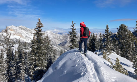
Eric Carter, a full time mountain athlete based in Squamish is part of the team behind The Weekly South Coast Conditions Report. Photo: Guy Fattal
THR: What is the basic template for the newsletter?
Carter: We do a quick intro, a review of where we’ve been skiing in the region that week, a detailed overview of the snowpack in the areas we visited, and a weather and avalanche forecast discussion. Then we answer two questions: what are our questions for the weekend, and what will we avoid entirely?
These questions are the most important part of the newsletter as they help readers take a step beyond the conditions/forecast and get to the heart of how we’re thinking about traveling in the mountains and making terrain choices. It’s easy to say, “OK—the hazard is considerable or high, so I’m just stepping back to simple terrain.”
But first of all—what does that specifically look like?
Second, WHY is the hazard what it is? In other words, what is the specific avalanche problem (wind slab, wet loose, etc), and where is it located (aspect, elevation, etc.)? And then, given that, could we, perhaps, make a more nuanced decision about where we will go skiing (and hopefully have a ton of fun) with those problems in mind?
THR: How is the newsletter’s information a supplement (I see it as additive) to the forecasting products disseminated by Avalanche Canada? For example, you folks are based in Squamish; I know AvCan forecasts for the Whistler zone—how can your newsletter support skiers/riders who come up from Vancouver who may read the AvCan forecast but are looking for more specific on-the-ground beta on conditions and snow stability?
Carter: First, Avalanche Canada has their work cut out for themselves. If you look at the size of the organization and the area they forecast for (all of Canada), what they do is incredible. Canada is huge and very remote, and that’s what makes it incredible. It draws me here over places like the Tetons, Wasatch, or Chamonix (though they are amazing for their own reasons). That remoteness, though, means getting good high-quality conditions information is difficult. It would be impossible to follow every Facebook and Instagram post along with every other method people use to share information.
Our newsletter aims to help people dive deeper into the public bulletin and give a bit more analysis that the forecasters just don’t have time or space for in their daily bulletin. We’ve got all week to think about it, whereas they are on a tight schedule. We hope folks can use our newsletter to better understand the big picture of what’s going on in the corridor and gain more insights from the bulletin.

The Weekly South Coast Conditions Report aims to provide information so backcountry users can make more informed decisions. Photo: Eric Carter
THR: How might the newsletter be helpful for an international traveler looking to explore the South Coast backcountry?
Carter: I’d like to think that for a visitor, the newsletter is going to give the best, most up-to-date snapshot of what the season and snowpack is looking like in our area at any given time. We include information on access and snowline for trailheads and discuss other hazards like glacier cover and crevasses. Think of it like the notes from the morning guides meeting but without all the weird acronyms. Combine that with the Avalanche Canada Public Bulletin, and you’ll get all the best information.
THR: What is your business model? The newsletter is free, with the option to pay for access. Further, how did you land on that model?
Carter: Subscribing to our newsletter is completely free. We want everyone to read it with as little barrier as possible. We send it out on Thursday nights so folks working during the week can plan their weekend. Anyone tourer getting particularly good use out of it is encouraged to become a “supporter” at $20 a month—that goes a long way to cover web hosting fees and all that.

Fine narrow terrain on the South Coast to keep the senses zeroed in. Photo: Eric Carter
If you missed it up top—you can find the Weekly South Coast Ski Conditions Report here.