
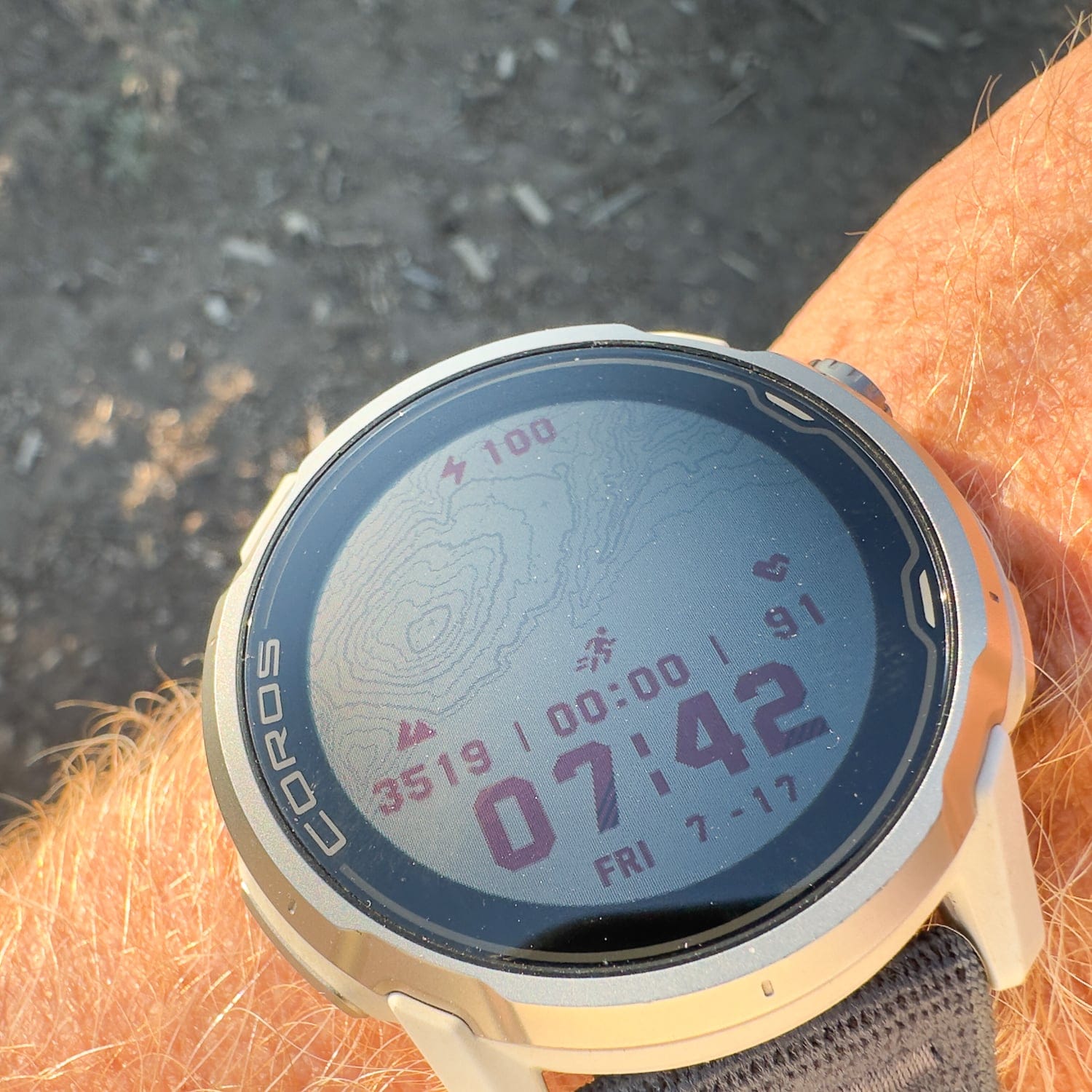
Writing for SEO (Search Engine Optimization) and then formatting said post for SEO to rank higher on Google isn’t our strong suit. But for the sake of brevity, and you want to scroll on by, the Coros Apex 4 is a keeper. While this is not a comparative article, a run down of the best, we are here to verify that the features we prioritized—battery life, mapping functionality, and cost—all rose to the occasion. More on this later.
I mentioned in the first look that seeking a GPS watch left me overwhelmed by choices—I called it “paralyzed by making the wrong choice.” Unless you are purchasing a gadget on the grounds of delayed obsolescence—meaning you might as well go for all the options so you don’t date your GPS watch prematurely—we held true to the premise that we only needed (need, too, is a stretch) certain features.
The Needed Essentials
The Coros Apex advertised exceptional battery life, and it delivered. Using the Apex 4 as a basic watch with basic functions, it lasts close to the advertised 24 days. At some point, we stopped counting around 20 days in endurance mode. The assumption here is that most long-haul trippers (expeditionary folks) haul a small solar panel and battery brick. Recharging is part of the day-to-day on such trips. In this mode, the watch will track basic biometric inputs, provide altitude readings, and function as a watch: alarms, a countdown timer (for nappers), and on and on.
As expected, when using higher-drain battery functions like navigating on a map, the battery burn rate increases while battery life decreases. There are three GPS profile settings that impact battery drain. In terms of increasing burn rate, Coros calls them Endurance, High, and Max modes. (The greater the GPS accuracy, the shorter the battery lasts.) With the Apex 4 46mm screen, that corresponds to—according to Coros—65, 51, and 43 hours respectively.
During long days (12-14 hours) of navigation, the battery drained roughly 30% in Max mode. That amounts to three long days of data collection and navigation before a recharge—depending on how close you want to push toward 0%. The battery life numbers Coros presents are accurate. This includes days when you might be following a track, and the watch is set to alert the user if they deviate a specified distance from the track.
The Apex 4’s excellent battery life has a lot to do with the screen, something we waxed about in the first look. The Apex 4 has a Memory-in-Pixel (MIP) screen. Many other GPS and smart watches have brighter, poppier, Active Matrix Organic Light Emitting Diode (AMOLED) screens. An iPhone has an AMOLED screen. AMOLED screens are marketed as easier to read in lower light settings; think dusk and dawn. Which is true—while the Apex 4’s screen (again, it’s MIP) can be manually backlit with a button, some argue a MIP screen is harder to read. We had no issues reading the MIP screen on the go. This included scenarios in the dark (yup +1 for the backlight) and on cloudy days. A MIP screen reflects sunlight, so the brighter the better. Again, we did not find the MIP screen to be an issue at dusk, or on cloudy low-light occasions, for example, when using the screen to navigate.
What we needed was exceptional battery life, and a MIP screen helps deliver that. Folks keen on a poppy-snappy vibrant screen should opt for a GPS watch with an AMOLED screen; there are many AMOLED-screen Coros, Garmin, and Suunto watches out there.
The duller part of the review relates to costs. No matter how you look at it, GPS watches are pricey. What you generally pay for, as prices increase, is enhanced functionality and a more refined build. For example, Coros’ well-regarded Pace 4 (marketed toward runners) costs $250.00. The Pace 4 loses some functionality for more adventure-minded folks, as it has more limited mapping and navigation features compared to the $429.00 Apex 4.
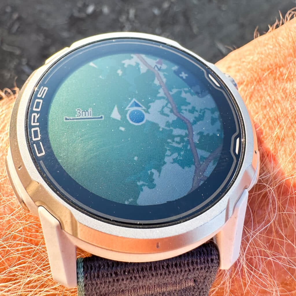
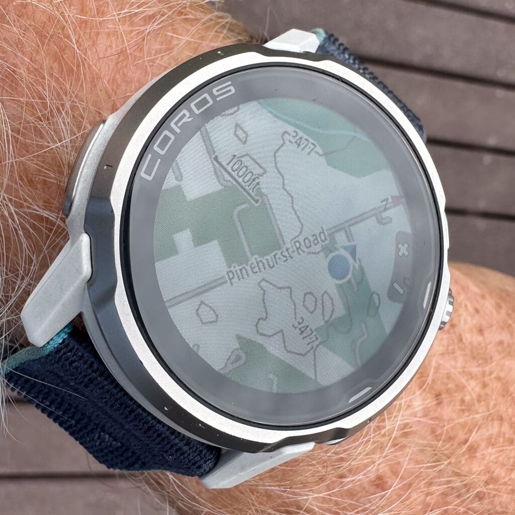
The Apex 4 offers landscape maps with trail and street names, as well as downloadable global maps with a topo overlay option. The Pace 4, on the other hand, offers only a breadcrumb map. Both offer deviation alerts, checkpoints, back-to-start, and map controls via a touchscreen.
Before I dive deeper into the map and nav capabilities, know that I have had no problems connecting the Apex 4 with satellites. As in zero issues. And the connection, if not immediate, generally occurs in about 10 seconds, even in tight, steep terrain with many obstructions.
The ability to use downloadable maps is worth the price of entry. Although folks have been using GPX tracks for years, for this late adopter, I’ve loved the ability to import and navigate by a track. This has come in handy most often when moving over vast terrain. And even more so when visibility shuts down or, as happened on one occasion, I was sucked up into terrain because it looked like a viable shortcut, and… it wasn’t. And then the sun began to set
I don’t think I’m ignoring any elephant in the room. Old school adventurers have been doing just fine without GPS watch navigation for millennia. So the rub might be that the purists among us want to remain more pure. That’s up to you—the finding of what personally sits right regarding the purity of it all. No doubt, we’ve become accustomed to phone navigation through apps like GAIA, onX, and Cal-Topo. Even more, I’ve been with folks in the Wasatch who use the Wasatch Backcountry Skiing App, a perhaps even more local/granular digital mapping/navigation tool. (Talk about breaking down the gatekeeping walls.)
I’m sure there are some out there, but it’s rare for any of us not to use digital mapping tools in some capacity. What I’ve appreciated about the Apex 4 is the opportunity to keep my phone zipped up in a pocket. I’ve found that the Apex 4’s downloadable maps (which are zoomable by rotating the scroll wheel—it resembles an old-school watch dial) and the ability to follow a track on a topo map help me keep the phone at bay. It also helps to be out of cell service and have notifications turned off, but I digress.
Of course, there is a downside. The APEX 4’s topo map is excellent for a 1.3-inch display, but there’s only so much detail to show. It is not a replacement for the detailed overlays offered in the aforementioned mapping tools—such as slope angle and slope aspect. And it definitely is not a replacement for basic situational awareness. In other words, a GPS watch with superb mapping/navigation, as I’ve found with this Coros piece, is not necessarily going to keep you safe in avalanche terrain. It might, though, coupled with solid skills, help you avoid that sort of terrain in some scenarios.
Here’s a good case study. Four of us were plopped below the Vowell Glacier in the Bugaboos. We worked our way up onto the main glacier and spent the next two days in a ping pong ball. There were periods of good visibility, but on day two, as the kilometers added up, visibility dropped to about 10 meters. We had a GPX track on a few phones and an Apex 4. When it fully shut down, we roped up, and pretty much the team in front (Ben and Aidan) were navigating by feel: a watch for Aidan, a phone for Ben. The Ape 4’s upside was the ability to keep striding while checking the wrist periodically to ensure we were on course. The other upside was the watch’s battery drain compared to the phone’s. The watch’s battery held up much better, which is probably no surprise; a warm battery drains slower, and keeping a phone warm while it is in your hand on a cold and gnarly day is a tall order.
I also found the mapping function excellent for establishing efficient entry and exit routes. This winter was not as advertised; it wasn’t super wintry down low. Up in the alpine, there was ample snow. In a few zones, between the dirt and snow, the approach and exit are matchsticked with downfall. So finding an efficient path through the maze became a pet project. The watch’s ability to track my line became an effective tool toward this end.
An Array of Features
As dizzying as the GPS/smartwatch review ecosystem is, so is the range of functions these watches feature. For the master blaster, pro, semi-pro, and just-for-the-fun-of-it athlete, the Apex 4, like any GPS watch worth its salt, is loaded. I’ll list out those functions in the specs section.
Generally, we found the metrics collected by the watch to be accurate. The basic data like distance traveled and vert gained, compared to my baseline understanding of local trails and approaches, was spot on. There were a few occasions when a partner and I had different watches, and our total vert at the end of the day varied a bit even though we were in close proximity throughout.
The wrist-optical HRM was accurate insofar as it usually aligned with my perceived effort. I don’t do structured intervals, yet I know when I’m bumping out of Zone 2. For those that want to go deep with their training—like you have a developed training plan—I see the Apex 4 as being a great tool to keep all that data collected, dialed, and useful. And if you are stressed about having more accurate HRM data, you can purchase a Coros armband HRM for $89.00.
An interesting feature is the SpO2 (blood oxygen saturation) monitor. You can do a spot check or regular interval checks in Altitude mode. Coros claims that Altitude mode provides “Regular evaluation of SpO2 and fitness when at high altitudes.” No surprise here, as you gain altitude, low SpO2 is a clear sign that you are not acclimatizing properly. But you probably already knew that, as you are feeling lethargic, have reduced appetite, or have a headache. While I think this type of wrist-worn monitor has a big upside, I’m not finding much out there about its accuracy, other than that these monitors are not medical-grade and can vary in accuracy. So, for the time being, I see this as a potential tool in the high hills for spotting possible trends in one’s acclimatization program.
Another aspect of the Apex 4 I have appreciated is the ability to record voice notes that are attached to a pin. I’m simply recording notes on the fly, so I don’t forget an idea. Later, I can download the voice recording to the Coros app and make note of it. I can see this as a useful feature for avalanche forecasters/educators, climbers/skiers, and glacier travelers who want to record an on-the-fly voice memo without taking the phone out.
(Although not a smartphone, you can take hands-free incoming calls on the Apex 4. It works. The sound is clear. But this is not part of my daily program.)
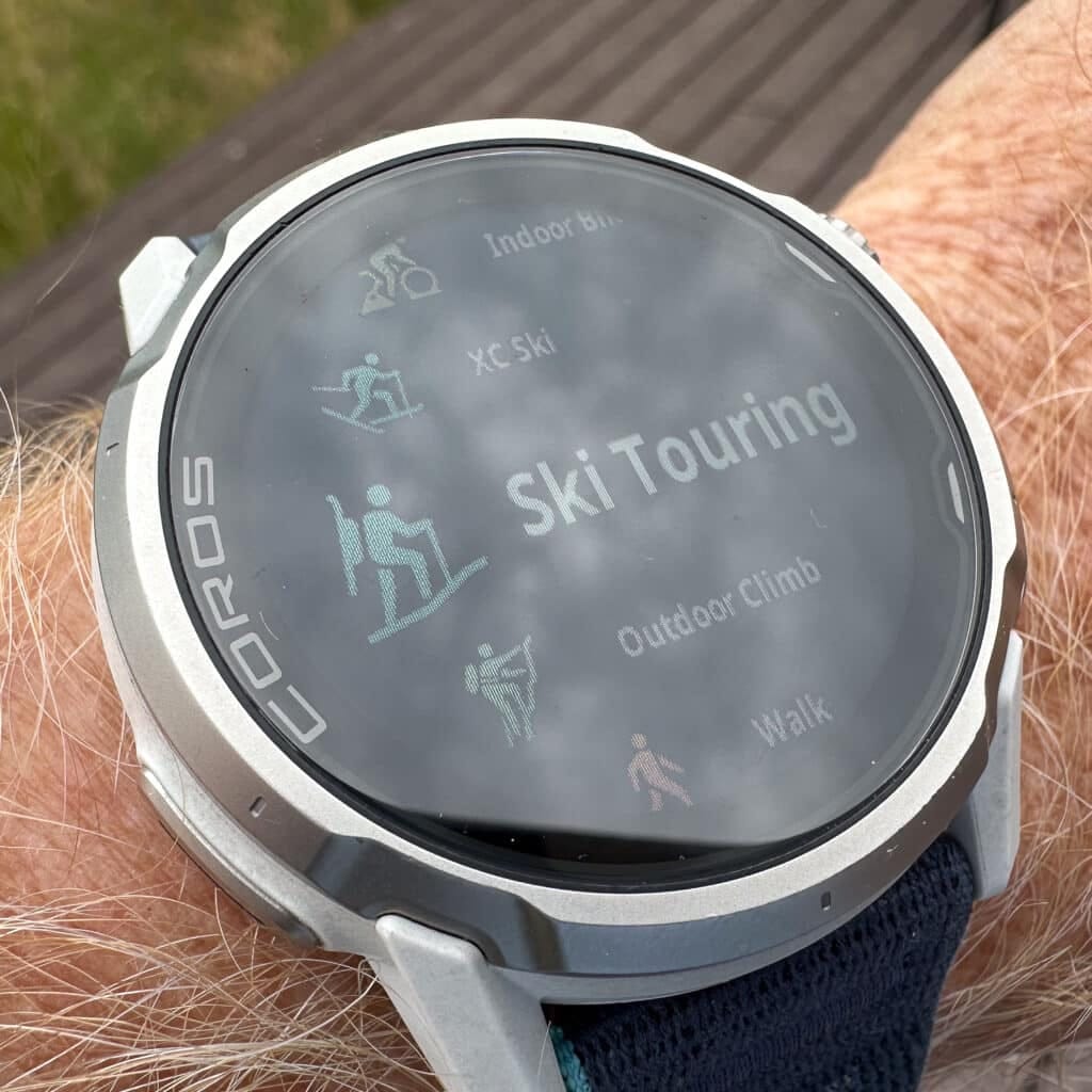
Data trackers might be happy to know there is a dedicated Ski Touring mode. Yeah, there’s a tidy little touring icon that will let you know you’ve chosen the proper sport mode. This sport mode is a combo of the Mountain Climb and XC-ski modes. Which means the watch simply defaults to Mountain Climb mode while ascending and XC Ski mode while descending. You can hit a button to switch over at a transition, which swaps the data collection function from ascent to descent, but I usually spaced this. But all that is automatic; if you just choose Ski Touring mode, the Mountain Climb/XC Ski show happens in the background. The watch, with its built-in accelerometer/GPS, will automatically switch over a few seconds after the skin ripping, clicking in, and descending.
Either on the watch or in the app, you see total distance, activity time, average heart rate, elevation gain, elevation loss, calories, training load, speed, cadence, and individual lap time.
When you complete your tour and dump the data into the Coros app on your phone, you’ll see the Ski Touring symbol next to the data. (The workout/tour data is available to view on the phone, too.) You can also set alerts in Ski Touring mode. However, if you want to customize settings in this mode, you must customize the settings in Mountain Climb and XC Ski mode. This is an upfront task to dial in the functionality you want. (Use the phone app to dial in those mode-specific settings, and then sync the watch.)
The Coros Phone App
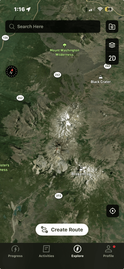
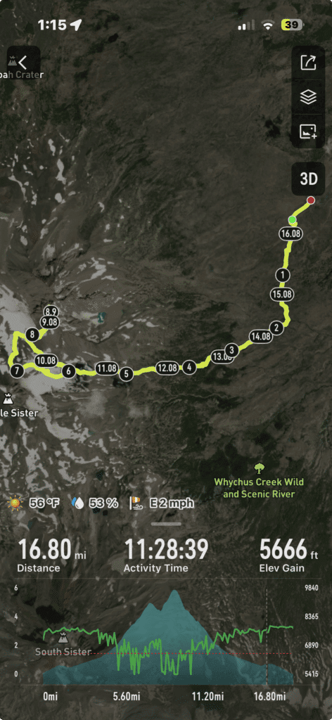
The watch interfaces with the phone app via Bluetooth. If the phone and watch are in close proximity, syncing is quick and seamless. To add maps to the watch, navigate to the map manager tool on the app, and select the map sections to download. Upon syncing with the watch, the new maps will be downloaded. It’s pretty much a two-step process.
Importing a GPX track is a bit more involved. Select a track to download (likely built in a third-party mapping app), and import it to your phone. Once on the phone, you can open the file in the Coros app. And… then sync with your watch. Although it is not too involved, we suggest practicing a bit to make it more seamless.
Lastly, you can use the app to create a route/track, too. Once saved on the app, make sure to sync up.
The One Downside
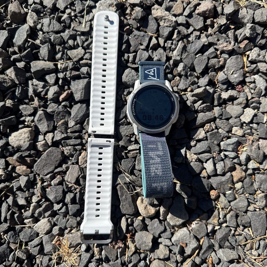
There’s one downside (for me) to the Apex 4, although it is rather minor. The standard silicone watchband is a dud. The snap-button closure routinely popped open; usually when removing a layer of clothing and pulling off a sleeve. While the snap-button closure looks clean, it’s not functional for those of us moving about outdoors. Coros sells a Velcro closure band called the “nylon” band, which is simple, dries quickly, and does not open inadvertently. If you are purchasing an Apex 4, select the “customize” option and opt for the nylon band at no extra cost. The silicone band comes standard: don’t opt for it until Coros changes the band’s closure system.
Circling Back to the First Look
In my first look, I wrote about my willful and pleasant years away from any data-collecting/GPS-type watch. I enjoyed understanding how my body felt absent any real data beyond perceived effort and how tired I felt afterward. If I felt tired, I knew I should take some time to rest. And if I felt like maybe I was trending in a direction I should not be going, call it sorta lost, I could pull out my phone.
As with any modern GPS watch, it takes some time to become familiar with the operating system, buttons, and app to become efficient with a watch like the Apex 4. The watch is controlled by a three-button layout, each with a specific function. Again, it takes time to learn which button corresponds to which function, but not too much time. Along with the buttons, you can also enable the touchscreen to operate certain functions. Overall, navigating the watch, toggling between all the functions, with the buttons or the touchscreen, over time, becomes second nature.
I am sold on the Apex 4’s ease of use, massive functionality (which is actually not uncommon for modern GPS watches), and the fact that it more than delivered on my criteria for a watch like this: price, battery life, and A+ grade mapping/navigation tools. And even in the 46mm size (it also comes in a 42mm watchface), it doesn’t sit on my wrist like a hockey puck. It seems rather unobtrusive and relatively thin, and this comes from someone who did not wear a watch for many years.
I now wear a watch pretty much daily. And with the long long battery life, if I am not logging a workout (I tend to only use the GPS function for bigger outings) I rarely have to recharge this sweet timepiece.
And because I could comment on many more functions, I’ll end it here. More to come.
| Dimensions | 46.2 x 46.2 x 13.7mm Height does not include the optical heart rate sensor |
| Weight | 64g (confirmed) with silicone band, 51g with nylon band |
| DISPLAY | |
| Display Size | 1.3 inches |
| Display Resolution | 260 x 260 pixels |
| Display Type | 3rd Generation Memory-in-Pixel touch screen |
| MATERIALS | |
| Screen Material | Sapphire Glass |
| Bezel Material | Grade 5 Titanium Alloy |
| Cover Material | Fiber Reinforced Polymer |
| Band Material | Silicone / Nylon |
| WATCH BAND | |
| Width | 24mm |
| Size – Nylon | 140mm – 215mm |
| Size – Silicone | 140mm – 215mm |
| Installation Type | Quick Release |
| DESIGN | |
| Buttons & Dials | Digital Dial Back Button, Action Button for shortcuts to your maps, Pins, and more. |
| CONNECTIVITY | |
| Phone | Bluetooth |
| Accessories | Bluetooth |
| Data Sync | Wi-Fi / COROS App |
| DURABILITY | |
| Water Resistance | 5 ATM Suitable for surface water activities and not for diving. |
| Working Temperature | -4°F to 122°F (-20°C to 50°C) |
| Storage Temperature | -4°F to 140°F (-20°C to 60°C) |
| BATTERY | |
| Standard Full GPS (GPS/QZSS) | —— |
| Endurance All Systems (GPS, GLONASS, Galileo, Beidou, QZSS) | 65 hours 17 hours with offline music playing |
| High All Systems (GPS, GLONASS, Galileo, Beidou, QZSS) | 53 hours 16 hours with offline music playing |
| Max Dual Frequency (GPS, GLONASS, Galileo, Beidou, QZSS) | 41 hours 15 hours with offline music playing |
| Daily Use & Sleep Tracking | 24 days |
| Charging Time | Less Than 2 Hours |
| MEMORY | |
| Internal Memory | 32GB |
| Activity Memory | 1200 Hours Estimates based on outdoor activities |
| GEO LOCATION | |
| Satellite Systems | GPS, GLONASS, Galileo, Beidou, QZSS |
| GNSS Chipset | All-Satellite Dual-Frequency |
| NAVIGATION | |
| Map Layer | Landscape (with trail and street names)Downloadable Global Maps Topo Downloadable Global Maps |
| Additional Features | Checkpoint Back-To-StartDeviation Alert Touchscreen-Enabled Map Control Safety Alerts |
| DATA TRACKING | |
| Sensors | Speaker to take hands-free calls or play activity alerts out loud. Microphone to record training logs, use voice commands, and save Voice Pins, Optical Heart Rate Monitor, May not work over tattoos, Barometric Altimeter, Accelerometer, Gyroscope 3D Compass, Thermometer, Supports body temperature in training (with compatible accessory), Optical Pulse Oximeter, Electrocardiogram Sensor |
| Training Features | Effort Pace: A personalized metric that represents true effort when running EvoLabRecovery, fatigue, training load, race predictor, VO2 max, threshold zones, and more metrics: Activity Alerts for cadence, distance, pace, heart rate, power, and more metrics. Basic/Advanced Interval Training, Pre-planned Workouts, Training Plans, Running Fitness, Resting Heart Rate Underwater, Heart Rate, Action Camera Control, Supports select GoPro, DJI, Insta360 camerasVirtual PacerVirtual RunRunning Form TestRequires COROS POD/POD 2Altitude ModeRegular evaluation of SpO2 and fitness when at high altitudes, Touch Scroll, Swipe to scroll data pages during trainingExtender |
| Daily Features | Daily Stress, Wellness Check, Message/Call Alert Supports daily use and during training Sleep with REM tracking, Alarm, Timer, Stopwatch, Daily Data Includes active calories, exercise time, storm, and more alertsUpdateable Firmware with Wi-Fi and the COROS app Find My Phone Find My Watch Always-On Display HRVMusicPlays offline music when paired with supported Bluetooth headsets |

Leave a Reply
You must be logged in to post a comment.