Intrigued by onX and its New ATES Layer
In the past few years, onX has shown a strong commitment to advancing their backcountry platform—the company has released a new ATES layer for select U.S. regions.
Read More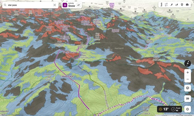
In the past few years, onX has shown a strong commitment to advancing their backcountry platform—the company has released a new ATES layer for select U.S. regions.
Read More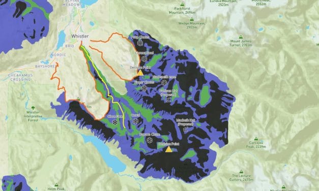
Real-world use of an ATES, can come into play when exploring unfamiliar terrain.
A great and free resource, (although it must cost Avalanche Canada money to produce and host), is their trip planner. Load the planner, and scroll and zoom on the Whistler zone to view specific terrain overlaid with ATES descriptions. The map provided is suitable for a first-step analysis: it is 2D, and once zoomed in sufficiently, populates with topo lines and even a track, for example, of the Spearhead Traverse. I can begin to analyze what type of avalanche exposure I can expect on the traverse.
Read More
A new ATES system, codified as ATES v.2, rates terrain between 0-4, with 0=non-avalanche, 1=simple, 2=challenging, 3=complex, and 4=extreme, respectively.
The introduction of “0”, described as “No known exposure to avalanches. Very low-angle or densely forested slopes located well away from avalanche paths, or designated trails/routes with no exposure to avalanches,” allows for a broader interpretation of the terrain.
Read More