To some, it is, the Greatest Snow on Earth. Mountain meteorologist from the University of Utah, Jim Steenburgh, discusses forecasting in the Wasatch ten years on from the publication of his book, Secrets of the Greatest Snow on Earth.
Wasatch locals and those who lust for the greatest snow on earth know of Jim Steenburgh, the brainchild behind Wasatch Weather Weenies—Mountain Meteorology and Snow Snobbery. Steenburgh’s blog is a digital go-to for those interested in mountain weather forecasts and how and when to line up the steep with the deep. Steenburgh is also the author of Secrets of the Greatest Snow on Earth, Second Edition: Weather, Climate Change, and Finding Deep Powder in Utah’s Wasatch Mountains and Around the World, originally published in 2014, while a new second edition was released in June.
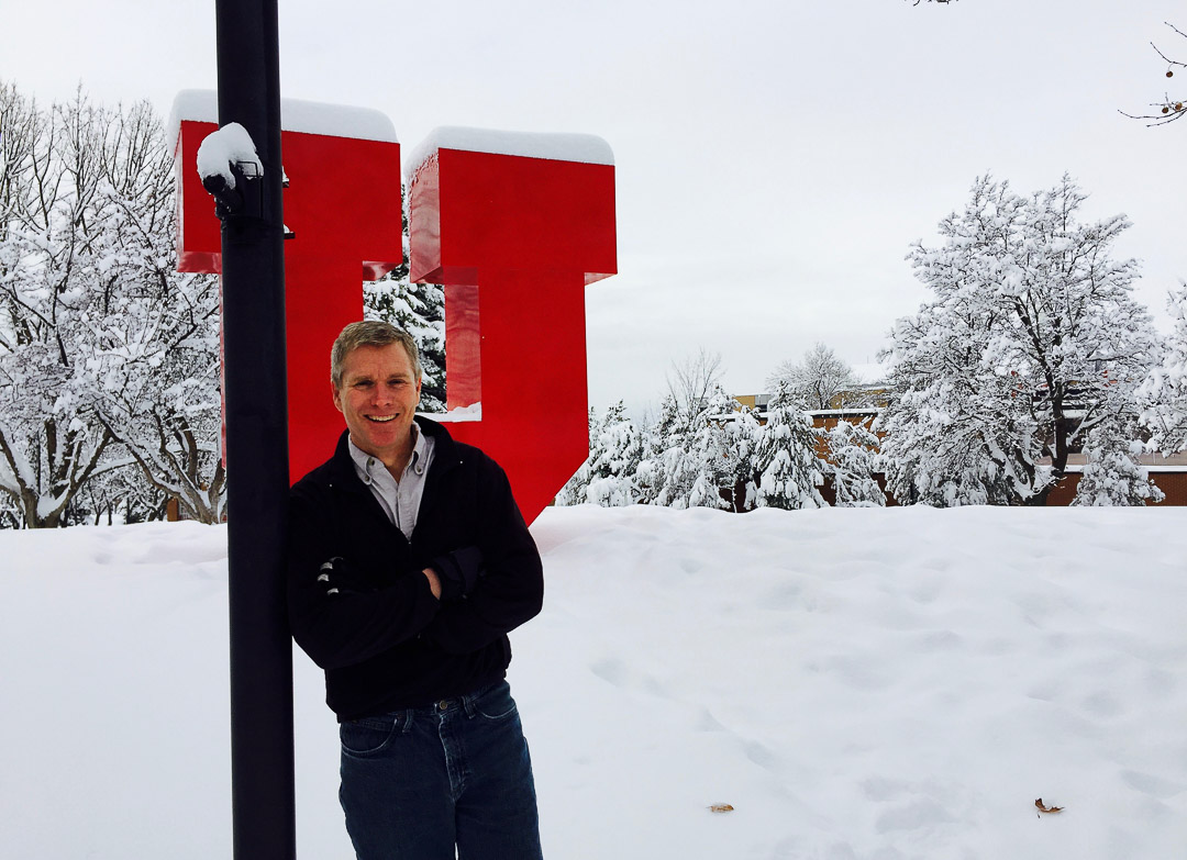
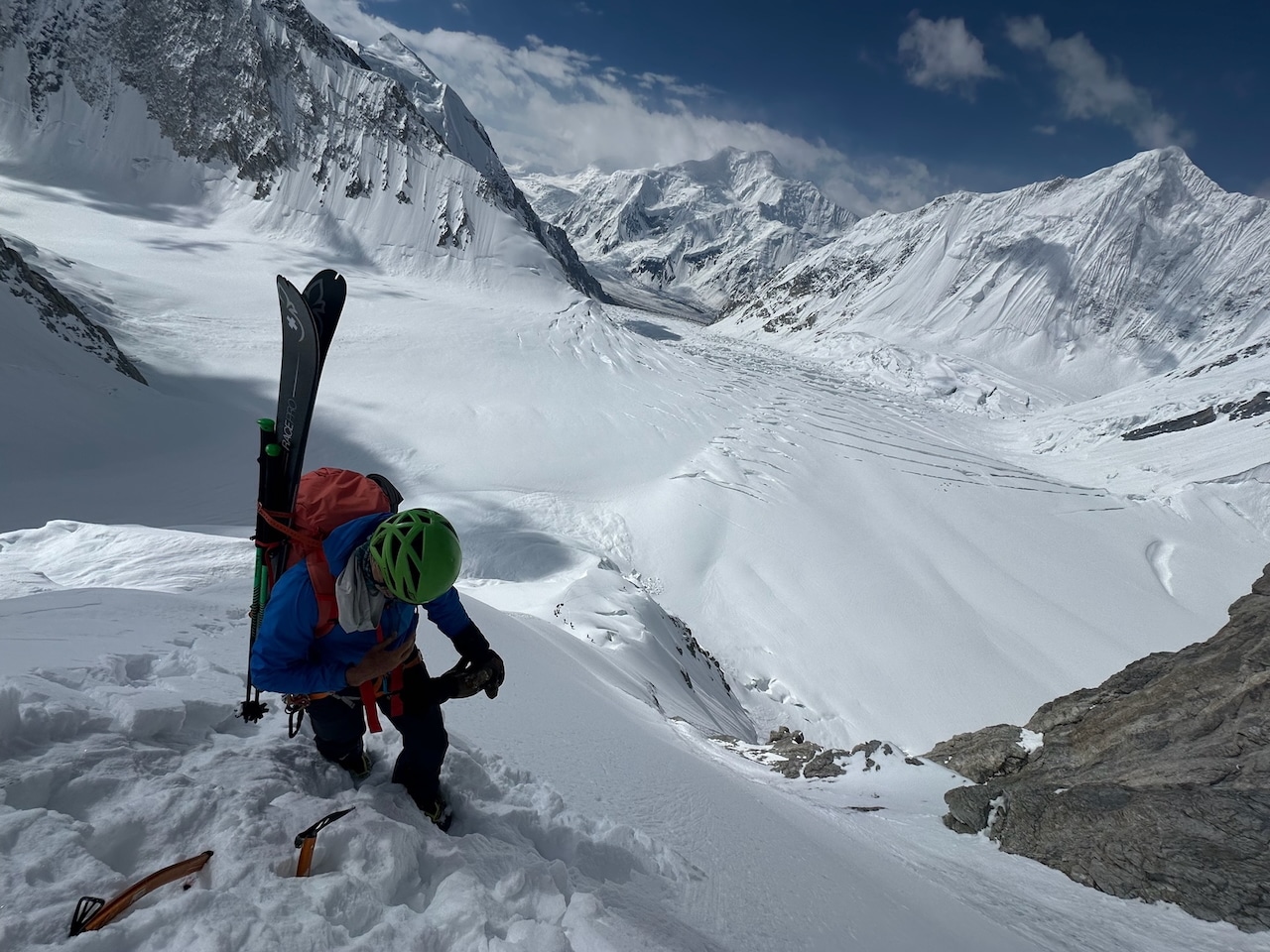
For 28 years, Steenburgh has been a professor at the University of Utah in the Department of Atmospheric Sciences, and specifically helping lead the Mountain Meteorology Group. He’s a backcountry skier bent on helping others understand the dynamic realm of mountain weather and forecasting. However, Steenburgh grew up in the western Adirondacks where he became familiar with the big dumps amidst the tug Hill Plateau.
Along with his book, Steenburgh teaches an online class geared towards meteorologically curious powder snow seekers titled: Secrets of the Greatest Snow on Earth. Steenburgh has the secrets and we’re in a kiss and tell mood. We had a recent chat with Steenburgh to learn more about his evolving knowledge of the Wasatch and the information he has gleaned since first publishing his book.
The interview has been condensed and lightly edited for clarity.
The High Route: I am curious from the macro level. It’s been a decade since you came out with your book, and since then, there’s been a lot of discussion in the mainstream media about the shrinking Great Salt Lake and its adverse impacts. Over, say, a decade, what have you learned about what’s going on regionally when it comes to the lake and impacting mountain weather?
Jim Steenburgh: We’ve been in this persistent mega-drought, if you want to call it that, for about 20 years. What we understand is that it’s probably partially related to natural variability. Some of it’s just bad luck. But what’s changing now is we’re getting what we sometimes call hot droughts, which are droughts that are hotter than they used to be.
What’s happening is the hydrologic system is changing. Because of that, evaporation and transpiration happen a lot faster, soils dry out faster, and there’s a high demand for water, whether for irrigation, farming, or irrigating your backyard.
This is an enormous challenge in the future with climate change. If we get the same inflows for the Great Salt Lake as we typically have had in the past, even if you just allow all the water to flow into the lake, the dice become loaded, making it harder for the lake to maintain a reasonable level. And then on top of that, for the last four decades now, we’ve been siphoning water off that should be going to the lake. And so, the biggest reason the lake is down is human diversion, which has been exacerbated during a drought period.
These are some big challenges. It’s going to be very hard, I think, to, in the very long run, manage the lake without somehow getting more water to it. I don’t know. And I don’t know how to solve that. That’s not a meteorological problem. That’s a political and an engineering problem.
The High Route: One thing that comes up, and I know you wrote about this a while ago, is the over-emphasis on this whole idea of lake effect snow. For people who don’t live in Utah, like me, can you describe a little bit for people who don’t live there, or for perhaps even people that live there, what is the true impact of The Great Salt Lake when you’re talking about mountain weather in your zone of the Wasatch?
Steenburgh: In the Cottonwoods, it’s about an average of about 5% of the cool season precipitation, so from October through April. We’ve done studies that vary from year to year: it can be as much as 10 or 12%. And it can be as little as almost zero. It depends on the patterns in any given year.
We have lots of southwesterly flow storms, and you don’t get much lake effect. If you get lots of northwest flow, we start to get more. That was based on a study over about a 10 or 13-year period when the lake was near or just below its average elevation and area.
I usually tell people about 5% to 8% of the total snowfall in the Cottonwoods is lake effect. Outside the Cottonwoods, if you’re up in the northern Wasatch, or if you’re on the Wasatch back, or if you’re down in the southern Wasatch, it’s a lower number than that.
Everybody talks about lake effect, but if you look at a year, like last year, where Alta just got destroyed, right? Nine hundred three inches of snow, the vast majority of that was not lake effect.
If you want to see lake effect, you go to a place like upstate New York, and you go to Tug Hill Plateau, and they average about 280 inches a year, but that’s a much bigger lake; Lake Ontario is 300 kilometers long, whereas the Great Salt Lake is about 100. Or if you go to Japan, you know, they’re much larger bodies of water, they produce a lot more lake effect.
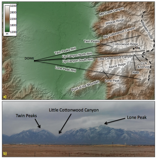
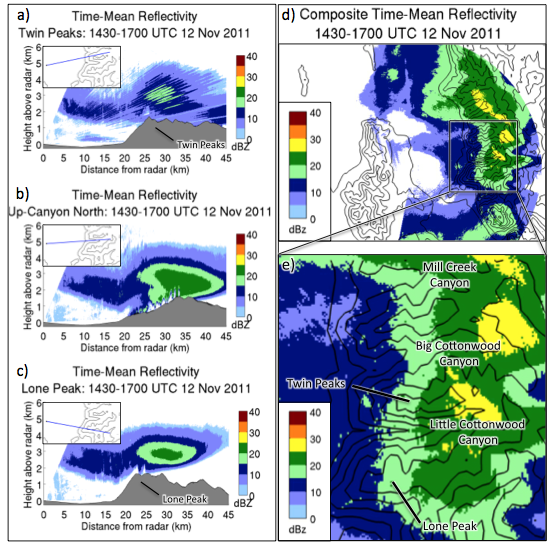
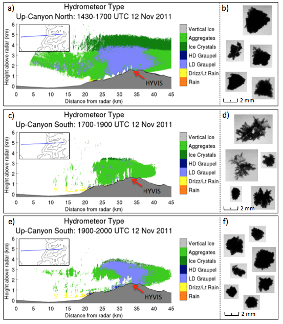
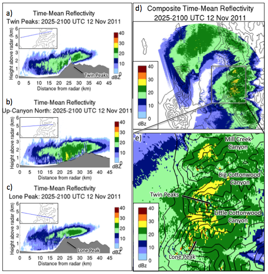
Even if you don’t reside in the Wasatch, the Weather Weenie site is well worth a deep dive. For example, an April 8, 2014 post titled “A Cool Look at Snowfall in Little Cottonwood Canyon,” highlights the data collected from specifically positioned radar as a winter storm rolls through. By reading the site, and following Steenburgh’s lead, your mountain weather forecasting skills will improve. Below is a series of four images found in the April 8, 2014 post.

Leave a Reply
You must be logged in to post a comment.